



Introduction
Geoinformatics is the science of acquiring, analyzing, and interpreting geographical information.
It supports effective decision-making by applying geographical information to practical needs.
Meanwhile, land surveying provides accurate data for infrastructure projects and land management in Nigeria.
Brief Explanation of Geoinformatics
Geoinformatics integrates geospatial data with GIS, GPS, and remote sensing technologies.
These technologies help professionals create interactive maps and models.
Therefore, geoinformatics connects geographical information with advanced digital tools.
Importance of Land Surveying in Nigeria
Land surveying ensures proper land demarcation in Nigeria.
It reduces land disputes and facilitates urban planning.
Additionally, surveying supports sustainable agriculture and natural resource management.
How Geoinformatics Is Revolutionizing Land Surveying
With geoinformatics, Nigerian land surveyors collect, analyze, and visualize data more efficiently.
They also handle geographical information with improved accuracy.
Consequently, improved analysis supports better decision-making.
History of Land Surveying in Nigeria
Land surveying in Nigeria dates back to pre-colonial times, when people used indigenous methods.
These practices helped people measure and organize land before modern surveying technologies appeared.
Over time, surveying practices developed as new tools and methods entered Nigeria.
Traditional Methods Used in Land Surveying
Traditional surveyors used chains to measure distances across land.
They used compasses and theodolites to establish directions and angles.
Together, these instruments supported land measurements and map preparation.
Challenges Faced by Land Surveyors in the Past
Earlier surveyors often produced less accurate measurements than modern methods allow.
Their procedures also required considerable time to complete.
Limited access to reliable data further complicated land measurement and mapping.
Geoinformatics and Its Impact on Land Surveying
Geoinformatics has revolutionized land surveying in Nigeria through advanced data collection and analysis tools.
Surveyors now use GPS, GIS, and remote sensing to map land more accurately and efficiently.
These technologies improve the precision and speed of surveying tasks.
They also support the production of detailed and reliable maps.
Furthermore, geoinformatics improves collaboration among surveyors, government agencies, and other stakeholders.
That collaboration strengthens land management activities.
It also supports better decisions in urban planning, infrastructure development, and natural resource management.
Geoinformatics increases transparency, accountability, and effectiveness in land administration.
These improvements help reduce land disputes and encroachments.
By adopting geoinformatics, Nigerian land surveyors have improved their professional standards.
They consequently provide better services to clients and the public.
These advances have transformed how professionals map and manage land resources.
Applications of Geoinformatics in Land Surveying
Geoinformatics is reshaping land surveying practices in Nigeria.
Surveyors combine spatial data with digital tools to improve surveying activities.
These technologies support mapping, location measurement, and land change monitoring.
- GIS mapping and analysis: GIS creates detailed maps and supports spatial analysis for surveying decisions.
- GPS location data: GPS helps surveyors identify precise locations in real time.
- Remote sensing: Satellite imagery helps surveyors monitor changes in land cover.
Advantages of Geoinformatics for Surveying
Geoinformatics improves how surveyors collect, manage, and interpret land information.
It also helps professionals complete surveys more efficiently and consistently.
Furthermore, spatial analysis gives decision-makers clearer information for land management.
- Enhanced efficiency: Digital tools accelerate data collection and analysis while saving time and resources.
- Improved accuracy: GPS provides precise location data and reduces survey errors.
- Better decisions: GIS reveals spatial relationships that support informed land management choices.
Challenges Affecting Geoinformatics Adoption
Despite its benefits, geoinformatics adoption presents several practical difficulties.
Transform Your Career with Expert Guidance
Get personalized mentorship consulting that’s tailored to your unique path. Our expert advice is actionable and exclusive.
Get StartedOrganizations must address financial, technical, and data management requirements.
Effective planning can help surveying teams manage these limitations.
- Cost implications: Equipment, software, and training can require substantial initial investment.
- Technical expertise: Surveyors need specialized skills to operate GIS, GPS, and remote sensing technologies.
- Data interoperability: Different formats can complicate data integration, sharing, and analysis.
Future Opportunities for Geoinformatics in Nigeria
Future investment can expand the role of geoinformatics in Nigerian land surveying.
Training programs can help surveyors use advanced technologies more effectively.
Meanwhile, geoinformatics can support urban planning and environmental management.
- Capacity building: Training and skills development can strengthen surveyors’ technical capabilities.
- Smart cities: Geoinformatics can support urban planning and sustainable city development.
- Environmental monitoring: Remote sensing can help manage natural resources and support conservation efforts.
Find Out More: Public Spaces in Nigeria: Design and Architecture
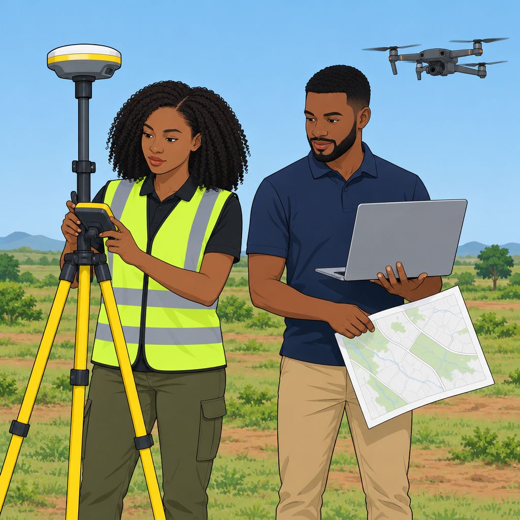
Benefits of Geoinformatics in Land Surveying in Nigeria
Geoinformatics offers several advantages for land surveying activities in Nigeria.
It improves data collection, supports land use decisions, and strengthens stakeholder collaboration.
These benefits help surveyors manage information more efficiently and produce reliable results.
- Increased efficiency and accuracy in data collection
- Improved decision-making for land use planning
- Enhanced communication and collaboration among stakeholders
Increased Efficiency and Accuracy in Data Collection
Geoinformatics helps Nigerian land surveyors gather precise information with advanced technology.
For example, GPS technology and Geographic Information Systems improve the accuracy of collected survey data.
Consequently, these tools reduce errors that often occur during manual data collection.
They also support reliable results throughout the surveying process.
Furthermore, geoinformatics tools enable surveyors to update information in real time.
Improved Decision-Making for Land Use Planning
Geoinformatics allows land surveyors to analyze information for better land use planning in Nigeria.
By combining datasets and maps, surveyors can identify suitable locations for development projects.
This approach supports informed decisions about how people use available land.
It also helps surveyors identify potential conflicts before development begins.
Additionally, geoinformatics promotes sustainable land use practices.
Environmental information further supports efforts to preserve natural resources.
Enhanced Communication and Collaboration Among Stakeholders
Geoinformatics improves communication among stakeholders involved in land surveying projects.
Shared access to geospatial information keeps participants informed about project developments.
It also helps stakeholders track important changes as projects progress.
As a result, participants can make decisions through a collaborative process.
This cooperation can support better outcomes for everyone involved.
Moreover, geoinformatics integrates feedback from different sources.
That integration creates a more comprehensive approach to land surveying.
Geoinformatics and the Transformation of Land Surveying
Geoinformatics continues to transform land surveying practices in Nigeria.
Its tools connect accurate data collection with informed planning and collaborative project management.
Therefore, geoinformatics plays an important role in strengthening the land surveying sector.
See Related Content: Architecture Awards and Recognitions in Nigeria
Challenges of Implementing Geoinformatics in Land Surveying
Land surveyors in Nigeria face several challenges when implementing geoinformatics.
Limited training can prevent surveyors from using geoinformatics tools effectively.
Additionally, high costs and integration difficulties can slow adoption among surveying firms.
- Limited awareness and training restrict effective geoinformatics use among many Nigerian land surveyors.
- High acquisition and maintenance costs make geoinformatics tools difficult for many surveying firms to afford.
- Integration difficulties can create resistance when firms combine geoinformatics with traditional surveying practices.
Strategies for Addressing Implementation Challenges
Surveying professionals can address these challenges through coordinated and practical strategies.
Training programs can strengthen technical knowledge and help surveyors use geoinformatics more effectively.
Furthermore, partnerships and improved integration can reduce costs and support smoother transitions.
- Invest in training and awareness programs. These programs can improve surveyors’ geoinformatics knowledge and skills.
- Seek funding and partnerships. Government agencies, NGOs, and private organizations can help secure financial support.
- Promote integration and interoperability. Workshops, seminars, and demonstrations can encourage cooperation between geoinformatics and traditional surveying.
You Might Also Like: Automotive Design and Manufacturing Courses in Nigeria
Successful Geoinformatics Projects in Nigeria
Several geoinformatics projects have improved land surveying in Nigeria.
These initiatives have influenced communities, government operations, and environmental management.
Digital mapping and spatial analysis support stronger land administration and planning.
Featured Geoinformatics Projects
Several projects demonstrate geoinformatics applications in Nigerian land administration.
These systems combine spatial data with digital tools for improved decision-making.
They also support more efficient surveying, planning, and land management processes.
Lagos State Geographic Information System
LASGIS has transformed land administration in Lagos State.
The system uses advanced mapping technology to streamline land registration processes.
Consequently, LASGIS has reduced fraud and improved state revenue generation.
Abuja Geographic Information System
AGIS has improved land-use planning and management in the Federal Capital Territory.
The system provides accurate digital maps and spatial data for planning activities.
As a result, AGIS helps prevent unplanned development and reduce land disputes.
Land Information System in Ogun State
Ogun State implemented a Land Information System for efficient land management.
The system digitizes land records and stores information in a centralized database.
Therefore, it strengthens land tenure security and supports property transactions.
Community and Environmental Impacts
Geoinformatics projects have produced important benefits for Nigerian communities.
They have also improved government land administration and environmental decision-making.
Several effects demonstrate the value of spatial data and digital mapping.
- Geoinformatics strengthens land tenure security and property rights for individuals and communities.
- It improves access to land information and documentation.
- Consequently, land administration becomes more transparent and accountable.
- Digital tools increase efficiency during land surveying and management activities.
- They also produce faster and more accurate land assessments and valuations.
- Geospatial data helps resolve boundary issues and reduce land disputes.
- Better planning supports sustainable land use and environmental conservation.
- Improved registration processes help governments generate revenue through taxation mechanisms.
These projects show how geoinformatics can strengthen land administration and urban planning.
They also demonstrate the role of spatial data in environmental conservation.
Nigeria can continue using these technologies to support citizens and future generations.
See Related Content: Top Mechanical Engineering Projects in Nigerian Universities
Geoinformatics and Sustainable Land Surveying in Nigeria
Geoinformatics has transformed land surveying in Nigeria by improving accuracy, efficiency, and data management.
It has also accelerated data collection, analysis, and visualization for more informed decision-making.
Furthermore, stakeholders use geoinformatics to identify and resolve land disputes more effectively.
The technology has strengthened land administration, titling, and broader land management practices.
Geoinformatics’ Role in Transforming Land Surveying
Geoinformatics provides advanced tools that continue to reshape land surveying practices in Nigeria.
These tools improve surveying accuracy, efficiency, and effectiveness while supporting stronger land management.
Moreover, geoinformatics helps stakeholders make decisions, resolve disputes, and streamline land administration.
Stakeholder Investment in Sustainable Land Management
Stakeholders must embrace and fund geoinformatics to support sustainable land management in Nigeria.
Government agencies, private organizations, and individuals can use these technologies to optimize operations.
Consequently, wider adoption can reduce costs and improve efficiency across the land surveying sector.
Additional Resources
Google search results for Geoinformatics: Transforming Land Surveying in Nigeria Engineering
Bing search results for Geoinformatics: Transforming Land Surveying in Nigeria Engineering


