



Introduction
Geoinformatics plays a crucial role in disaster management and response.
It provides valuable spatial information for decision-making.
Therefore, decision-makers can use this information during disaster management and response.
Definition of Geoinformatics
Geoinformatics is the science and technology that uses geographic data to solve complex problems.
The science combines geographic data with technology.
Consequently, the field addresses complex problems through geographic information.
The Role of Geoinformatics in Disaster Management
Geoinformatics helps predict disasters by analyzing spatial data.
It also supports disaster assessment through geographic analysis.
Additionally, it helps create maps for disaster response.
Importance of Geoinformatics in Disaster Response
Geoinformatics enables quick identification of affected areas.
It supports accurate resource allocation during disaster response.
Moreover, it improves coordination among emergency response efforts.
Geoinformatics Tools and Technologies for Disaster Management
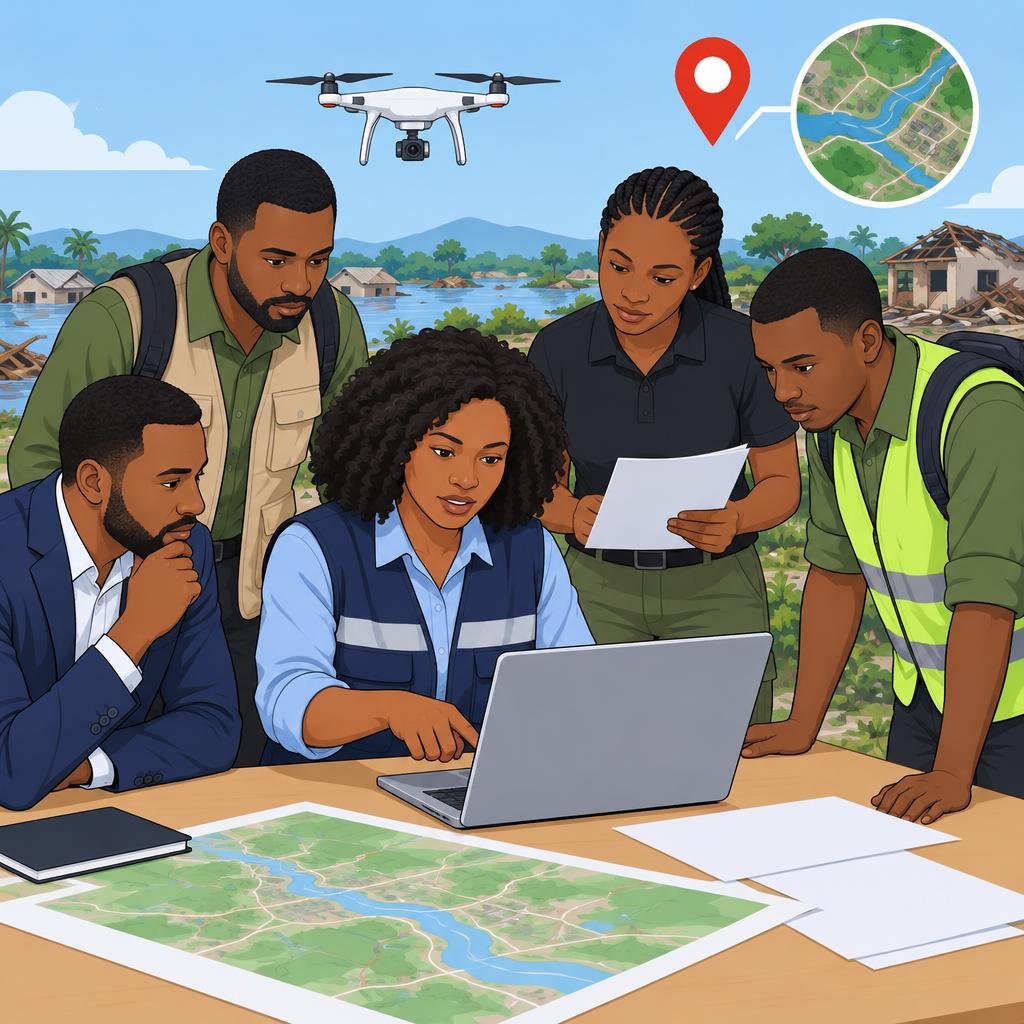
Disaster managers use geoinformatics tools to collect, analyze, and display spatial information.
These technologies support mapping, monitoring, tracking, reconnaissance, and rapid analysis during disasters.
Together, they help responders examine conditions and coordinate activities more effectively.
- GIS maps, analyzes, and visualizes spatial data for disaster management.
- Remote sensing uses satellites and aerial drones to provide valuable disaster monitoring data.
- GPS tracks and locates resources, responders, and affected areas during disasters.
- Drones support disaster reconnaissance, damage assessment, and search and rescue operations.
- Real-time mapping software helps responders visualize and analyze disaster data quickly.
Benefits of Using Geoinformatics Tools in Disaster Management
Geoinformatics tools give responders timely information about changing disaster conditions.
Furthermore, these tools support coordinated decisions about resources, damage, communication, and preparedness.
They also help response teams identify priorities and act with greater speed.
- Geoinformatics tools improve situational awareness through timely data for informed emergency decisions.
- GIS and GPS improve resource allocation and deployment during disaster response efforts.
- Remote sensing and drones enable faster damage assessments and help prioritize urgent areas.
- Geoinformatics tools strengthen communication and coordination among response teams.
- Historical data and risk maps support stronger disaster planning and preparedness.
Challenges in Implementing Geoinformatics in Disaster Management
Organizations may face practical barriers when they adopt geoinformatics tools for disaster management.
Data, technical, regulatory, and system-related issues can complicate disaster operations.
Therefore, agencies must address these challenges to support effective multi-agency responses.
- The initial cost of geoinformatics tools can challenge organizations and agencies.
- Teams may struggle to ensure accurate data and integrate diverse sources.
- Organizations need suitable training and technical expertise to use these tools effectively.
- Regulations and restrictions can limit data collection and use.
- Different systems may lack interoperability during multi-agency response efforts.
Future Trends in Geoinformatics for Disaster Management
Emerging technologies will continue to expand geoinformatics capabilities for disaster management.
These developments can improve data collection, analysis, access, and communication during disasters.
Meanwhile, community participation can strengthen mapping efforts and disaster resilience.
- Artificial intelligence and machine learning can improve geoinformatics analysis and predictions.
- Internet of Things integration can strengthen real-time data collection and monitoring.
- Mobile applications can provide responders and affected populations with easier information access.
- Community engagement can improve data collection and mapping through citizen science initiatives.
- Enhanced visualization can clarify complex geoinformatics data for decision-makers.
Geospatial Support for Disaster Operations
Geoinformatics supports disaster management by connecting spatial information with emergency decisions.
It helps stakeholders coordinate activities, evaluate conditions, and reduce disaster impacts.
Furthermore, real-time analysis allows emergency teams to respond quickly as situations change.
Applications in Disaster Management
Geoinformatics supports several important activities before, during, and after disasters.
These activities help authorities identify hazards, organize responses, and support affected communities.
The following applications show how spatial analysis strengthens disaster operations.
- Early Warning Systems: Geoinformatics detects potential hazards by monitoring weather patterns, water levels, and related indicators.
- Damage Assessment: Spatial information reveals damage to buildings, infrastructure, and natural resources after disasters.
- Search and Rescue Operations: Geospatial data directs rescue teams toward affected areas and people needing assistance.
- Resource Allocation: Mapping tools identify locations requiring relief supplies, services, and emergency support.
- Risk Mapping and Analysis: Spatial analysis identifies hazardous areas and supports strategies that reduce future risks.
Early Warning Systems
Early warning systems provide timely alerts to communities facing possible disasters.
Geoinformatics analyzes seismic activity, wind patterns, precipitation, and other geographical data.
As a result, authorities can issue warnings and support safe evacuations before conditions worsen.
Damage Assessment
Emergency teams assess damage to prioritize relief activities and distribute resources effectively.
Satellite imagery and drones provide detailed views of affected locations.
These images help responders identify damaged infrastructure, evaluate community impacts, and plan recovery actions.
Search and Rescue Operations
Search and rescue teams use geospatial information to locate affected people quickly.
Detailed maps show hazardous areas, accessible routes, and possible evacuation paths.
Additionally, GPS data and geographic databases help teams navigate difficult terrain and coordinate rescue activities.
Resource Allocation
Disaster managers must deliver food, water, medical supplies, and other assistance without unnecessary delays.
Transform Your Career with Expert Guidance
Get personalized mentorship consulting that’s tailored to your unique path. Our expert advice is actionable and exclusive.
Get StartedGeoinformatics identifies urgent needs, maps logistics routes, and supports efficient distribution planning.
Real-time tracking can show supply movements and reveal bottlenecks during relief operations.
Risk Mapping and Analysis
Risk mapping helps authorities identify vulnerable regions before disasters occur.
Analysts combine historical information, geographical features, and climate patterns to create risk maps.
These maps guide land-use planning, infrastructure investment, and community preparedness efforts.
Strengthening Preparedness and Resilience
Geoinformatics improves situational awareness throughout disaster management activities.
It also helps decision-makers coordinate responses and address risks before emergencies develop.
Through these capabilities, communities can strengthen preparedness, improve response coordination, and protect lives and property.
Learn More: Leading Automobile Engineering Companies in Nigeria
Geoinformatics Applications in Disaster Response
These case studies show how geoinformatics supported assessment, mapping, coordination, and warnings during disasters.
Satellite imagery, GIS technology, and monitoring data supported different response needs.
Authorities used this information to guide rescue, relief, evacuation, and resource allocation.
-
Hurricane Katrina in the United States
During Hurricane Katrina, geoinformatics supported disaster response activities.
Satellite imagery helped authorities assess the extent of the damage.
Authorities used those assessments to prioritize rescue and relief efforts.
-
Earthquake in Nepal
Following the earthquake in Nepal, geoinformatics helped map affected areas.
It also helped identify areas at high risk of landslides.
Rescue teams used this information to allocate resources and reach people needing assistance.
-
Tsunami in Japan
After the tsunami in Japan, geoinformatics provided real-time damage information.
Authorities used this information to coordinate their response efforts.
GIS technology also supported evacuation planning and resource allocation.
-
Floods in Nigeria
During floods in Nigeria, geoinformatics helped authorities monitor water levels.
It also helped predict areas where flooding was likely to occur.
Authorities used this information for early warnings and rescue coordination.
Delve into the Subject: Cybersecurity Threats Facing Nigerian Businesses
Challenges of Implementing Geoinformatics in Disaster Management
Geoinformatics can strengthen disaster management, but organizations must address several implementation barriers.
These barriers can reduce the value of spatial information during planning and emergency operations.
Therefore, agencies need practical systems, reliable data, and capable staff to use this technology effectively.
- Organizations often lack skilled personnel who can operate geoinformatics tools effectively.
- Expensive software and equipment can limit investment by organizations with restricted budgets.
- Disaster managers need accurate, current data, but collecting and verifying it can prove difficult.
- Geoinformatics can create privacy concerns when agencies collect and share sensitive information.
- Incompatible platforms can prevent agencies from sharing information smoothly during emergencies.
Without trained professionals, organizations may not use geoinformatics tools to their full potential.
Moreover, high technology costs can prevent organizations from adopting systems for disaster planning and response.
Accurate data supports informed decisions, while outdated information can weaken emergency actions.
Consequently, agencies must regularly update and verify their data to maintain its reliability.
Privacy protection becomes essential when disaster operations involve sensitive personal or location information.
Agencies must balance effective information sharing with respect for individual privacy rights.
Furthermore, incompatible systems can create information silos among agencies managing the same disaster.
These silos can hinder communication, coordination, and collaborative emergency decision-making.
Addressing these challenges can help stakeholders use geoinformatics more effectively during disaster management.
Better training, responsible investment, reliable data practices, privacy safeguards, and compatible systems can support this goal.
Gain More Insights: Prominent Nigerian Biomedical Engineers to Know
Future Trends in Geoinformatics for Disaster Management
Future geoinformatics developments will connect emerging technologies with disaster management needs.
These developments will strengthen data collection, analysis, security, and emergency decision making.
Together, they will expand how stakeholders use spatial information during disasters.
Integration with Internet of Things
IoT devices will collect data in real time during disasters.
These devices will support continuous monitoring of changing conditions.
Consequently, geoinformatics systems will receive timely information for emergency activities.
Artificial Intelligence for Predictive Analysis
AI algorithms will analyze geospatial data for predictive analysis.
They can help identify possible disaster occurrences and assess potential impacts.
Therefore, emergency stakeholders can use analyzed information to support timely decisions.
Blockchain Technology for Secure Data Management
Blockchain technology will protect the integrity of shared geospatial data.
It will strengthen secure data management among various stakeholders.
As a result, participants can place greater trust in exchanged information.
Big Data Analytics for Real-Time Decision Making
Big data analytics will process geoinformatics information during emergencies.
This integration will support quick decision making and rapid responses.
Furthermore, stakeholders can use real-time analysis to guide emergency actions.
Learn More: Challenges in the Nigerian Automobile Engineering Sector
Strengthening Disaster Preparedness Through Geoinformatics
Geoinformatics strengthens disaster management by providing spatial data and analysis tools for effective emergency response.
Furthermore, these capabilities support early warning systems, damage assessment, resource allocation, and emergency decision-making.
Governments and organizations should invest in geoinformatics technologies and infrastructure to improve disaster preparedness and response.
Moreover, training programs and capacity-building initiatives equip professionals to use geospatial technology effectively during disaster response.
Additional Resources
Google search results for Geoinformatics in Disaster Management and Response Engineering
Bing search results for Geoinformatics in Disaster Management and Response Engineering


