




Introduction
Geophysical surveys in Nigeria study Earth’s subsurface.
These studies help researchers understand underground composition.
Consequently, survey methods reveal information about materials below the ground.
Importance of Geophysical Surveys
These surveys support oil and gas exploration.
They also assist mining, environmental assessment, and infrastructure development.
Furthermore, these applications demonstrate the value of subsurface information across several industries.
Types of Geophysical Surveys
Nigeria uses several geophysical survey methods.
These methods include seismic, magnetic, gravity, and electrical resistivity surveys.
Together, these techniques provide different ways to study subsurface conditions.
Exploration for Oil and Gas Reserves in the Niger Delta Region
Geophysical surveys support oil and gas exploration in Nigeria’s Niger Delta region.
These surveys use several techniques to identify potential hydrocarbon deposits beneath the Earth’s surface.
Consequently, exploration teams can evaluate subsurface conditions before selecting drilling locations.
Survey Techniques for Hydrocarbon Exploration
Seismic reflection sends waves into the ground and analyzes their reflections.
This process creates subsurface images and helps locate potential oil and gas traps.
Additionally, electromagnetic surveys measure rock conductivity to identify reservoirs with different electrical properties.
- Seismic reflection creates subsurface images that help locate potential oil and gas traps.
- Electromagnetic surveys detect conductivity differences associated with hydrocarbon reservoirs.
- Gravity surveys identify anomalies that may indicate sedimentary basins containing oil and gas deposits.
Survey Outcomes and Industry Impacts
Geophysical surveys have supported significant oil and gas discoveries in the Niger Delta region.
As a result, these discoveries strengthened Nigeria’s position in the global energy market.
The survey data also helped companies identify new exploration targets and maximize hydrocarbon production.
Furthermore, companies used the information to select drilling locations and reduce exploration risks.
This improved decision-making increased the efficiency of oil and gas extraction operations.
These activities contributed to Nigeria’s economic growth and enhanced its energy security.
Geophysical Survey for Mineral Exploration in Jos Plateau
This survey examined mineral potential in Nigeria’s Jos Plateau region.
The investigation focused on identifying valuable subsurface mineral deposits.
Furthermore, the survey supported mineral exploration planning in the region.
Geophysical Methods Used for Mineral Exploration
- Ground Penetrating Radar mapped subsurface features and detected potential mineral deposits.
- Magnetic surveys identified anomalies associated with possible mineralization.
- Electrical resistivity tomography mapped subsurface resistivity and located potential ore bodies.
Survey Results and Mining Sector Significance
- The survey revealed promising zones with high potential for gold, tin, and lead deposits.
- These findings indicate valuable resources for Nigeria’s mining sector.
- Survey data can guide targeted exploration and future mining project development.
- Additionally, geophysical surveys can reduce exploration risks and support economically viable discoveries.
Find Out More: Anthropology vs. Sociology: Differences and Overlaps in Nigeria
Groundwater Exploration in Northern Nigeria
Groundwater exploration remains vital in northern Nigeria because communities face water scarcity.
Geophysical surveys help investigators locate potential groundwater sources beneath the ground.
These investigations support efforts to improve access to reliable water supplies.
Geophysical Tools Used During the Survey
Electrical Resistivity Tomography measures subsurface electrical resistivity to identify potential aquifers.
Ground Penetrating Radar uses radar pulses to image subsurface formations.
Seismic Refraction sends seismic waves through the ground to measure subsurface sound velocity.
- Electrical Resistivity Tomography helps identify areas with electrical properties associated with potential aquifers.
- Ground Penetrating Radar helps locate water-bearing formations through subsurface imaging.
- Seismic Refraction helps investigators assess subsurface conditions using seismic wave velocities.
Survey Implications for Water Scarcity
Survey results can guide communities toward potential groundwater sources.
Consequently, efficient exploration can reduce dependence on unreliable surface water sources.
Furthermore, improved access to clean groundwater can support public health and agricultural productivity.
- Identifying groundwater sources can help provide sustainable water supplies for communities.
- Efficient exploration can reduce reliance on surface water that contamination may affect.
- Clean groundwater access can support better public health outcomes and agricultural productivity.
Delve into the Subject: Career Opportunities in Applied Botany in Nigeria
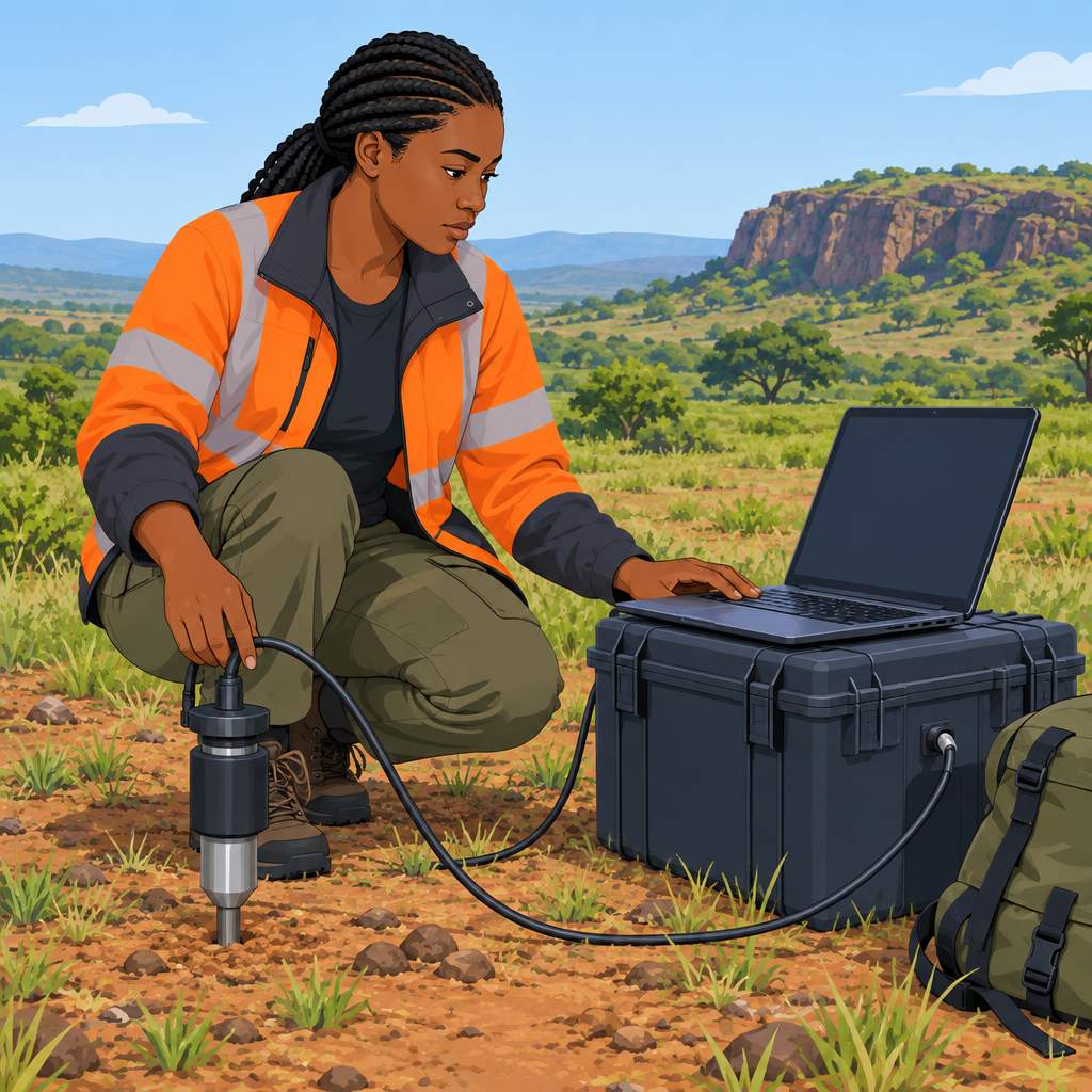
Geophysical Survey Applications Across Nigeria
These case studies demonstrate how geophysical surveys address different subsurface needs across Nigeria.
Seismic reflection revealed potential hydrocarbon reserves in the Niger Delta region.
Ground penetrating radar mapped underground utilities in the northern region, while electromagnetic surveys identified potential groundwater resources centrally.
- Seismic reflection revealed potential hydrocarbon reserves in the Niger Delta region.
- Ground penetrating radar mapped underground utilities in the northern region.
- Electromagnetic surveys identified potential groundwater resources in the central region.
Challenges Affecting Geophysical Surveys in Nigeria
Several obstacles limit the effective conduct of geophysical surveys in Nigeria.
Insufficient funding restricts access to equipment and qualified manpower.
Transform Your Career with Expert Guidance
Get personalized mentorship consulting that’s tailored to your unique path. Our expert advice is actionable and exclusive.
Get StartedMoreover, skills shortages complicate data interpretation, while poor infrastructure hinders access to remote terrain.
- Insufficient funding for equipment and manpower hinders geophysical survey implementation.
- A shortage of skilled geophysicists creates difficulties during data interpretation and analysis.
- Poor infrastructure and logistics complicate access to remote and difficult terrain.
Strategies for Strengthening Geophysical Survey Implementation
Targeted improvements can strengthen geophysical survey implementation across the country.
Training can develop local talent, while partnerships can combine public resources with private expertise.
Additionally, better infrastructure and public awareness can support access, interest, and investment.
- Invest in training and development to strengthen local geophysical expertise.
- Use public-private partnerships to combine resources and technical knowledge.
- Improve infrastructure and access to remote areas through government collaboration.
- Promote awareness of geophysical surveys to encourage interest and investment.
Uncover the Details: Interviews with Leading Nigerian Agri-Economists
Geophysical Surveys and National Development
Geophysical surveys remain important for Nigeria’s resource exploration and development.
Investment in these surveys can support significant discoveries and economic growth.
Their continued use can strengthen Nigeria’s efforts to assess resource potential.
Findings from Nigerian Case Studies
Nigerian case studies demonstrate the effectiveness of geophysical surveys.
These investigations identified valuable mineral deposits and oil reserves.
They also mapped geological structures and assessed resource potential.
Future Investment in Resource Exploration
Further research can advance Nigeria’s development through geophysical surveys.
Stakeholders should support initiatives that promote continued survey work.
Such investment can help Nigeria unlock its mineral and resource potential.
Additional Resources
Google search results for Case Studies of Geophysical Surveys in Nigeria Sciences
Bing search results for Case Studies of Geophysical Surveys in Nigeria Sciences


