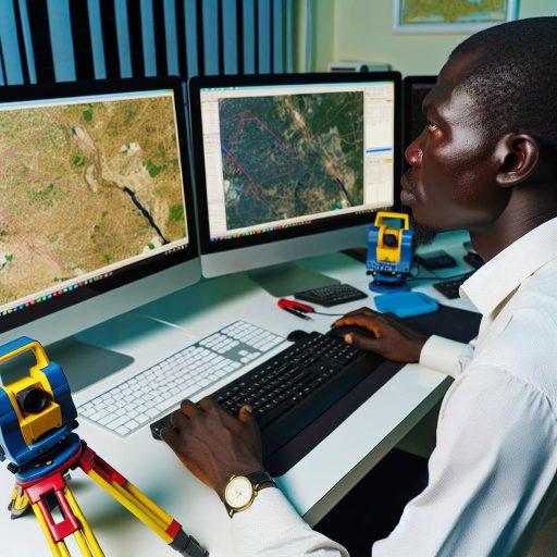
Surveying plays a crucial role in both rural and urban areas.
It provides valuable data for planning, development, and land management.
Definition of Surveying
Surveying is the process of measuring and mapping an area.
It determines boundaries, distances, and elevations.
Importance of Surveying in Both Rural and Urban Areas
In rural areas, surveying helps in demarcating land for agricultural purposes.
It also aids in the construction of roads and infrastructure development.
In urban areas, it is essential for city planning, construction, and property boundaries.
Key Differences Between Surveying in Rural and Urban Areas
One key difference is the scale of surveying projects.
Urban areas require more detailed and complex surveys.
This is due to higher population density and infrastructure.
Additionally, the terrain in rural areas is often more varied.
It can be challenging to survey compared to the relatively flat terrain in urban areas.
Surveying equipment and technology in urban areas are more advanced.
These tools cater to the specific needs of urban development.
In rural areas, simpler and more traditional methods are often sufficient.
Surveyors in urban areas need to consider existing structures and utilities.
They also account for underground infrastructure.
In rural areas, the focus is on natural features and topography.
Overall, while the fundamental principles of surveying remain the same,
the application and techniques differ significantly between rural and urban areas.
Surveying in Rural Areas
Surveying in rural areas presents unique challenges compared to urban areas.
The vast and often remote nature of rural landscapes requires surveyors to adapt their methods to ensure accurate measurements and data collection.
Challenges faced in surveying rural areas:
- Accessibility: Rural areas may lack proper roads or paths, making it difficult for surveyors to reach the survey site.
- Land Ownership Disputes: In rural areas, boundaries may not be clearly defined, leading to disputes over land ownership.
- Weather Conditions: Rural areas are prone to extreme weather conditions, which can affect surveying equipment and accuracy of measurements.
- Technological Limitations: Limited access to technology and resources in rural areas can pose challenges for surveyors.
Differences in terrain and topography:
Rural areas often have diverse terrain and topography, which can impact surveying methods and measurements.
Surveyors must account for hills, forests, rivers, and other natural features that are common in rural landscapes.
Importance of accurate measurements in rural areas:
- Property Development: Accurate surveys help in planning and developing rural areas for agriculture, infrastructure, and other purposes.
- Resource Management: Precise measurements are crucial for managing natural resources in rural areas, such as water bodies and forests.
- Disaster Prevention: Accurate surveys provide data for assessing risks and planning disaster prevention measures in rural communities.
- Infrastructure Projects: Survey data is essential for designing and implementing infrastructure projects like roads, bridges, and utilities in rural areas.
Surveying in Urban Areas
Urban areas present unique challenges for surveyors due to the high density of structures and population.
The use of advanced technology has become essential in urban surveying to effectively collect accurate data.
Challenges Faced in Surveying Urban Areas
- Tight spaces make it difficult to set up surveying equipment.
- High levels of noise and distractions can affect concentration.
- Constant movement of people and vehicles may disrupt surveying activities.
- Underground utilities and infrastructure pose a risk to surveyors.
Density of Structures and Population
The tightly packed buildings and high population in urban areas make surveying a complex task.
Surveyors need to navigate through narrow streets and crowded areas to access survey points.
The presence of tall buildings can obstruct line of sight and GPS signals, leading to inaccuracies in measurements.
The sheer number of structures in urban areas also means that each surveying project requires meticulous planning to ensure thorough coverage of the area.
Use of Advanced Technology in Urban Surveying
To overcome the challenges posed by urban environments, surveyors have turned to advanced technology for assistance.
Laser scanning, LiDAR, drones, and GPS devices are now common tools used in urban surveying.
These technologies allow surveyors to collect precise data efficiently, even in the most congested areas.
3D modeling and digital mapping software help in visualizing and analyzing the survey data, making it easier to identify spatial relationships and anomalies.
Delve into the Subject: Scholarships for Marine Engineering Students in Nigeria
Differences in Surveying: Rural vs Urban Areas
When it comes to surveying, the environment in which the survey is conducted plays a crucial role.
Surveying in rural areas brings about a unique set of challenges and requirements compared to urban areas.
Transform Your Career with Expert Guidance
Get personalized mentorship consulting that’s tailored to your unique path. Our expert advice is actionable and exclusive.
Get StartedLet’s delve into the key differences between surveying in rural versus urban areas.
Tools and Techniques in Rural Surveying
Rural surveying often requires different tools and techniques compared to urban areas due to the nature of the terrain and landscape.
Traditional surveying tools used in rural areas:
- Compass: A compass is a vital tool for determining directions in rural areas where landmarks may be scarce.
- Tape Measure: Used for measuring distances between various points on the land accurately.
- Level: A level helps ensure that the land being surveyed is flat and even.
- Plumb Bob: This tool is used to ensure that structures are built vertically.
Incorporation of modern technology in rural surveying:
With advancements in technology, modern tools are also being used in rural surveying to improve accuracy and efficiency.
- GPS: Global Positioning System technology is commonly used for accurate mapping and measurement of rural areas.
- Drones: Drones provide aerial views of the land, which can be useful for surveying large rural areas.
- GIS: Geographic Information Systems help in storing, analyzing, and visualizing spatial data obtained from rural surveys.
- Laser Scanners: These scanners provide detailed 3D images of the land for precise measurements.
Importance of local knowledge and expertise in rural surveying:
One key aspect of surveying in rural areas is the reliance on local knowledge and expertise to navigate the unique challenges presented by the environment.
- Understanding of terrain: Locals have valuable insights into the terrain, which can aid in accurate surveying.
- Knowledge of boundaries: Understanding property boundaries and land ownership is crucial in rural surveying.
- Cultural considerations: Being aware of cultural practices and sensitivities in rural areas is essential for successful surveying.
- Adaptability: Local surveyors are adept at adapting to the specific challenges of rural surveying.
While urban and rural surveying share some commonalities, the differences in tools, techniques, and reliance on local knowledge make rural surveying a unique and specialized field.
Explore Further: Marine Engineering Internships and Apprenticeships

Tools and Techniques in Urban Surveying
Advanced surveying instruments such as total stations, GPS receivers, and 3D laser scanners are commonly used in urban areas.
The use of these instruments allows surveyors to capture precise data quickly and efficiently.
Advanced Surveying Instruments Used in Urban Areas
Total stations combine the functions of theodolites and electronic distance measurement (EDM) devices for accurate angle and distance measurements.
GPS receivers utilize signals from satellites to determine precise positions on Earth, essential for mapping urban areas.
3D laser scanners create detailed point clouds of urban structures, aiding in the visualization and analysis of building shapes and dimensions.
Role of Geographic Information Systems (GIS) in Urban Surveying
GIS software plays a critical role in urban surveying by integrating spatial data for mapping and analysis purposes.
GIS helps surveyors manage, analyze, and visualize complex urban data sets for better decision-making processes.
By overlaying various layers of information, GIS enables urban planners to create detailed maps and models for development projects.
Need for Precision and Accuracy in Urban Surveying
Urban environments are characterized by dense infrastructure and limited space, requiring precise measurements for construction and development projects.
Accuracy in urban surveying is essential to avoid costly errors and ensure that buildings and infrastructure fit within designated spaces.
High levels of precision are necessary when surveying in urban areas to meet safety standards and regulatory requirements.
The use of advanced surveying instruments and GIS technology is essential for achieving accurate and reliable results in urban surveying projects.
Gain More Insights: Irrigation Systems Designed by Agricultural Engineers
Key Differences in Surveying Areas
Surveying in rural and urban areas presents unique challenges.
Accessibility is a significant factor in these locations.
Terrain complexity varies greatly between rural and urban landscapes.
Urban areas feature a high density of man-made structures.
The Role of Surveying
Surveying plays a crucial role in land development.
It is essential for infrastructure planning and resource management.
Future Directions in Surveying Practices
Further research in diverse environments is vital for improvement.
Exploration enhances efficiency and accuracy in data collection.
Understanding the differences in surveying can benefit professionals.
It contributes to sustainable development efforts.
Additional Resources
Rural–Urban Differences: Using Finer Geographic Classifications to …
Local Climate Zones for Urban Temperature Studies in: Bulletin of …


