Introduction
In Nigeria, surveying methods are crucial for land assessment and development planning.
Innovative surveying techniques are vital for accurately mapping the diverse Nigerian landscapes.
Traditional surveying methods may not always be sufficient due to the complex terrain and rapid urbanization.
Therefore, embracing innovative techniques is necessary to meet the demands of modern land surveying.
Traditional Surveying Methods in Nigeria
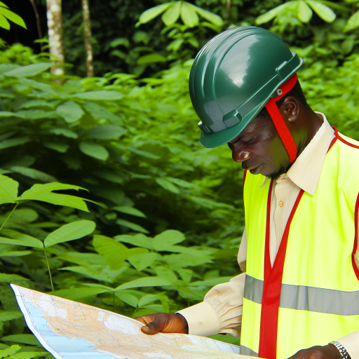
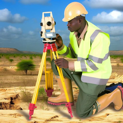
Traditional surveying methods have been utilized for centuries in Nigeria to map out land boundaries.
These methods determine property ownership and plan infrastructure projects.
Surveyors use basic tools, such as theodolites, levels, chains, and tapes, to measure distances and angles accurately.
Manual techniques like triangulation, traversing, and leveling help create accurate maps and plans.
These tools and techniques have been foundational in establishing property boundaries and facilitating land transactions.
Challenges Faced with Traditional Methods in Nigerian Landscapes
Despite historical significance, traditional surveying methods face challenges in Nigeria.
One major issue is the time-consuming nature of manual techniques.
This can delay project completion and lead to increased costs.
Moreover, reliance on basic tools and manual calculations can lead to errors and inaccuracies.
Such inaccuracies have serious implications for land disputes and construction projects.
The rugged terrain and diverse landscapes present unique challenges to traditional methods.
Lack of access to certain areas, dense vegetation, and difficult terrain complicate accurate mapping.
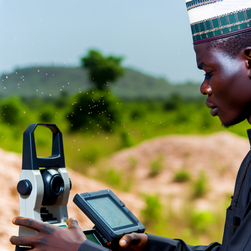
Need for Modernization and Innovation in Surveying Practices
Given the limitations of traditional methods, there is a growing need for modernization in practices.
By adopting new technologies and techniques, surveyors can overcome challenges posed by landscapes.
One innovative method gaining traction is the use of drones for aerial mapping.
Drones equipped with high-resolution cameras and GPS technology capture data quickly.
This technology provides surveyors with detailed maps and images for analysis.
Another modern technique is LiDAR (Light Detection and Ranging) technology.
LiDAR uses laser pulses to measure distances and create 3D representations of surfaces.
Surveyors can map terrain features with high precision and detail.
The integration of Geographic Information Systems (GIS) in surveying practices is essential for modernization.
GIS software allows the analysis of spatial data and the creation of digital maps.
This enhances decision-making processes and improves workflow efficiency.
The adoption of modern methods is crucial for overcoming challenges with traditional techniques.
They increase the accuracy, speed, and reliability of surveying practices in Nigeria’s diverse landscapes.
Benefits of innovative surveying methods
When it comes to surveying Nigerian landscapes, utilizing innovative methods can offer several advantages.
Let’s explore some of the key benefits:
Efficiency and accuracy in data collection
One of the primary benefits of innovative surveying methods is the ability to collect data more efficiently and accurately.
Advanced technologies such as drones and GIS software can streamline the process of data collection, enabling surveyors to gather information quickly and with precision.
This not only saves time but also ensures that the data collected is reliable and up-to-date, leading to more informed decision-making.
Improved mapping and visualization of landscapes
Traditional surveying methods may have limitations when it comes to mapping and visualizing complex landscapes.
Innovative approaches, such as 3D modeling and LiDAR technology, allow surveyors to create detailed and comprehensive maps of Nigerian landscapes.
These advanced mapping capabilities provide a more comprehensive understanding of the terrain, enabling better planning and development of land resources.
Cost-effectiveness and time-saving advantages
Implementing innovative surveying methods can also yield cost-effective and time-saving benefits.
By utilizing technology-driven tools, surveyors can streamline their workflow, reducing the need for manual labor and increasing efficiency.
This can result in significant cost savings for surveying projects, as well as faster project completion timelines.
Transform Your Career with Expert Guidance
Get personalized mentorship consulting that’s tailored to your unique path. Our expert advice is actionable and exclusive.
Get StartedAdditionally, the accuracy of data collected through innovative methods can help reduce the risk of errors and costly rework, ultimately leading to overall cost savings for land development initiatives.
Uncover the Details: Collaboration Opportunities in Nigerian Biomedical Engineering
Examples of Innovative Surveying Techniques
Use of drones for aerial surveys.
GIS mapping technology for detailed data analysis.
3D laser scanning for precise measurements.
Drones have transformed the way aerial surveys are conducted in Nigeria.
These unmanned aerial vehicles (UAVs) can capture high-resolution images and videos of vast landscapes with ease.
By using drones equipped with advanced cameras and sensors, surveyors can collect valuable data without the need for traditional ground-based methods.
This not only saves time but also reduces costs associated with hiring helicopters or airplanes for aerial surveys.
Additionally, drones can be programmed to follow specific flight paths, ensuring consistent coverage of the entire area being surveyed.
This level of precision allows surveyors to create detailed maps and 3D models of the landscape, providing valuable insights for various applications such as urban planning, agriculture, and environmental monitoring.
GIS Mapping Technology for Detailed Data Analysis
Geographic Information System (GIS) mapping technology has revolutionized the way survey data is analyzed in Nigeria.
Utilizing GIS software, surveyors can overlay spatial data, such as land boundaries, elevation, and vegetation cover, onto digital maps for comprehensive analysis.
This enables them to identify patterns, trends, and relationships within the data, helping to make informed decisions about land use and development.
GIS mapping technology also allows for the integration of various data sources, including satellite imagery, GPS data, and field surveys, to create detailed and interactive maps.
These maps can be customized to display specific information, such as soil types, land ownership, and infrastructure networks, providing valuable insights for land management and planning purposes.
Overall, GIS mapping technology enhances the accuracy and efficiency of survey data analysis, making it an indispensable tool for surveyors in Nigeria.
3D Laser Scanning for Precise Measurements
3D laser scanning technology is revolutionizing the way precise measurements are taken in Nigerian landscapes.
This cutting-edge technology uses laser beams to capture detailed and accurate 3D models of the terrain, buildings, and infrastructure.
By employing laser scanning devices mounted on tripods or vehicles, surveyors can capture millions of data points within a matter of minutes, providing highly accurate measurements for various applications.
The detailed 3D models generated through laser scanning can be used for visualizations, simulations, and measurements, making it easier to analyze and understand the topography of the land.
This technology is particularly useful for complex terrains, such as urban areas or rugged landscapes, where traditional surveying methods may be challenging or time-consuming.
With 3D laser scanning, surveyors in Nigeria can obtain precise measurements quickly and efficiently, improving the quality and accuracy of their survey data.
Delve into the Subject: Impact of Climate Change on Land Surveying Practices
Challenges and Limitations of Implementing Innovative Surveying Methods in Nigeria
Implementing innovative surveying methods in Nigeria comes with its fair share of challenges and limitations.
Some of the key issues hindering the adoption and successful implementation of these methods include:
- Cost of equipment and technology: One of the major challenges faced in adopting innovative surveying methods in Nigeria is the high cost associated with acquiring the necessary equipment and technology. Many organizations, especially small and medium-sized enterprises, may find it financially challenging to invest in state-of-the-art surveying tools.
- Limited access to training and expertise: Another significant limitation is the lack of skilled professionals with expertise in using advanced surveying technologies. Without proper training and access to experts, it becomes difficult for organizations to effectively utilize innovative methods in their surveying activities.
- Regulatory and legal barriers to adoption: The regulatory framework in Nigeria may pose obstacles to the widespread adoption of innovative surveying methods. Issues such as licensing requirements, land ownership laws, and bureaucratic processes can deter organizations from fully embracing new technologies and methodologies.
Delve into the Subject: Importance of Mechatronics in Nigerian Economy

Case studies of successful implementation
Surveying methods have played a crucial role in shaping the landscape of Nigeria.
Several projects showcase the effectiveness of innovative techniques.
Here are some noteworthy case studies that highlight the impact on land development, infrastructure planning, and natural resource management:
Project 1: Digital mapping for urban planning
In the city of Lagos, digital mapping technologies were employed to streamline urban planning processes.
By using drones and GPS systems, surveyors created high-resolution maps that accurately represented the city’s topography and existing infrastructure.
This data was then used to identify areas for development, allocate resources effectively, and plan for future growth.
Project 2: Satellite imagery for land use classification
In rural areas of Nigeria, satellite imagery has revolutionized land use classification.
This allows for more efficient agricultural practices and natural resource management.
By analyzing satellite data, surveyors identified land cover types, monitored changes in vegetation patterns, and assessed the impact of human activities on the environment.
This information has been instrumental in promoting sustainable land use and conservation efforts.
Project 3: LiDAR technology for infrastructure development
In the Niger Delta region, LiDAR technology was utilized to support infrastructure development projects.
LiDAR surveys helped to accurately map the terrain, identify suitable locations for roads and pipelines, and assess potential risks such as flooding and erosion.
This data played a crucial role in ensuring the successful implementation of infrastructure projects.
It minimized environmental impact and enhanced the resilience of critical infrastructure in the area.
Project 4: 3D modeling for urban design
In the capital city of Abuja, 3D modeling techniques were used to facilitate urban design and development projects.
By creating detailed three-dimensional models of buildings, streets, and landscapes, surveyors were able to visualize proposed developments.
This allowed them to assess the impact on the surrounding area and optimize design solutions for maximum efficiency.
This approach helped urban planners and developers to make informed decisions.
It enhanced public participation in the planning process and created sustainable urban environments.
These environments meet the needs of the growing population.
These case studies demonstrate the transformative power of innovative surveying methods in Nigerian landscapes.
By leveraging advanced technologies and data analysis techniques, surveyors have improved the efficiency, accuracy, and sustainability of land development, infrastructure planning, and natural resource management projects across the country.
Gain More Insights: Interior Design Trends in Nigeria’s Modern Architecture
Innovative Surveying Methods for Nigerian Landscapes
Innovative surveying methods are crucial for effectively mapping Nigerian landscapes.
Embracing technology and training enhances accuracy and efficiency in surveying.
Stakeholders must invest in advanced tools and knowledge to support sustainable development efforts.
By adopting innovation in surveying methods, we can overcome challenges and promote growth in Nigeria.
Let us work together to ensure the success of land surveying projects for a better future.
Additional Resources
Recent Advancements in Emerging Technologies for Healthcare …
(PDF) Bridging the engineering skill gap in Nigeria: Preliminary …