Introduction
Welcome to a journey through Nigeria’s landscapes and boundaries, explored through the lens of cartography. Maps serve as our guiding stars in this exploration, illuminating the diverse tapestry of Nigeria’s geography.
Brief Overview of Cartography
Cartography, the art and science of mapmaking, has deep roots in human history. From ancient civilizations sketching rudimentary land outlines to modern satellite imagery, maps have evolved into sophisticated tools of spatial representation.
Maps are not merely static images; they are dynamic narratives of a nation’s topography, political divisions, and cultural landscapes.
Through centuries of refinement, cartographers have crafted maps that tell stories of conquests, migrations, and technological advancements.
Importance of Maps in Understanding Geography
Maps play a crucial role in unraveling the complexities of geography. They offer a visual context that words alone cannot convey, depicting physical features like mountains, rivers, and forests with precision.
Through maps, one can trace the natural contours that shape Nigeria’s diverse terrain.
Moreover, maps outline political boundaries, revealing administrative divisions from states to local governments.
These delineations highlight Nigeria’s governance structure, showcasing how regions are organized and governed within the federal framework.
Beyond physical and political geography, maps illuminate cultural landscapes. They mark the locations of cities, towns, and villages, each with its own history and societal fabric.
Cultural maps of Nigeria showcase linguistic diversity, religious affiliations, and ethnic compositions, painting a vivid portrait of the nation’s societal tapestry.
Exploring Nigeria through Maps
Let us embark on a cartographic journey across Nigeria’s vibrant landscape.
From the bustling metropolises of Lagos and Abuja to the serene shores of Calabar and the arid expanses of the Sahel in the north, each region tells a unique story etched in cartographic detail.
In the southwest, maps unveil the lush forests of Ogun and the ancient city of Ibadan, steeped in Yoruba culture and traditions.
Moving northwards, the maps reveal the sweeping plains of the Savannah, home to nomadic Fulani herders and bustling market towns.
Venturing eastward, the maps depict the Niger Delta’s intricate network of creeks and mangroves, where oil-rich lands meet traditional fishing communities.
Meanwhile, in the southeast, maps capture the verdant hills of Enugu and the bustling streets of Onitsha, heartlands of Igbo heritage and commerce.
Essentially, cartography is not merely about drawing lines on paper but about weaving together the diverse threads of geography, culture, and history into a coherent narrative.
Through maps, we gain a deeper understanding of Nigeria’s rich tapestry, navigating its landscapes and appreciating its complexities.
As we continue this journey, let us embrace the power of maps to illuminate, educate, and inspire, guiding us through Nigeria’s past, present, and future with clarity and insight.
Join us as we delve deeper into “Mapping Nigeria: A Cartographic Journey.”
Historical Mapping of Nigeria
When we talk about the historical mapping of Nigeria, we are essentially delving into a fascinating journey that traces the evolution of cartography in this diverse African nation.
Evolution of maps in Nigeria
Maps of Nigeria have evolved over centuries, reflecting the changing landscape and geopolitical dynamics of the region. Early maps were rudimentary sketches, primarily used for navigation and exploration.
As explorers and traders ventured into the interior of Nigeria, they began to document their findings through more detailed maps. These maps often highlighted natural features, resources, and indigenous communities.
The colonial period saw a significant leap in mapping practices, with European powers like Britain and France creating detailed maps of Nigeria for administrative purposes.
These maps were instrumental in demarcating boundaries and asserting colonial control.
Influence of colonialism on mapping practices
Colonialism had a profound impact on mapping practices in Nigeria. European powers imposed their cartographic traditions and surveying techniques, leading to the standardization of mapping methods across the country.
The colonial authorities used maps to facilitate resource exploitation, land ownership, and governance.
This systematic mapping laid the groundwork for modern cartography in Nigeria, shaping the perception of the country’s geography.
Development of indigenous cartographic traditions
Despite the influence of colonial mapping practices, Nigeria also developed its indigenous cartographic traditions. Local communities began to create maps that reflected their cultural and ecological knowledge of the land.
These indigenous maps often incorporated oral histories, spiritual beliefs, and environmental cues.
They provided a unique perspective on Nigeria’s geography, challenging the dominant narratives imposed by colonial maps.
Basically, the historical mapping of Nigeria is a complex tapestry of colonial legacies, indigenous knowledge, and evolving cartographic practices.
By understanding this rich history, we gain valuable insights into the diverse landscapes and cultures that define Nigeria today.
Read: Challenges in Nigerian Curriculum Studies
Contemporary Mapping Technologies
Use of GIS and GPS in mapping Nigeria
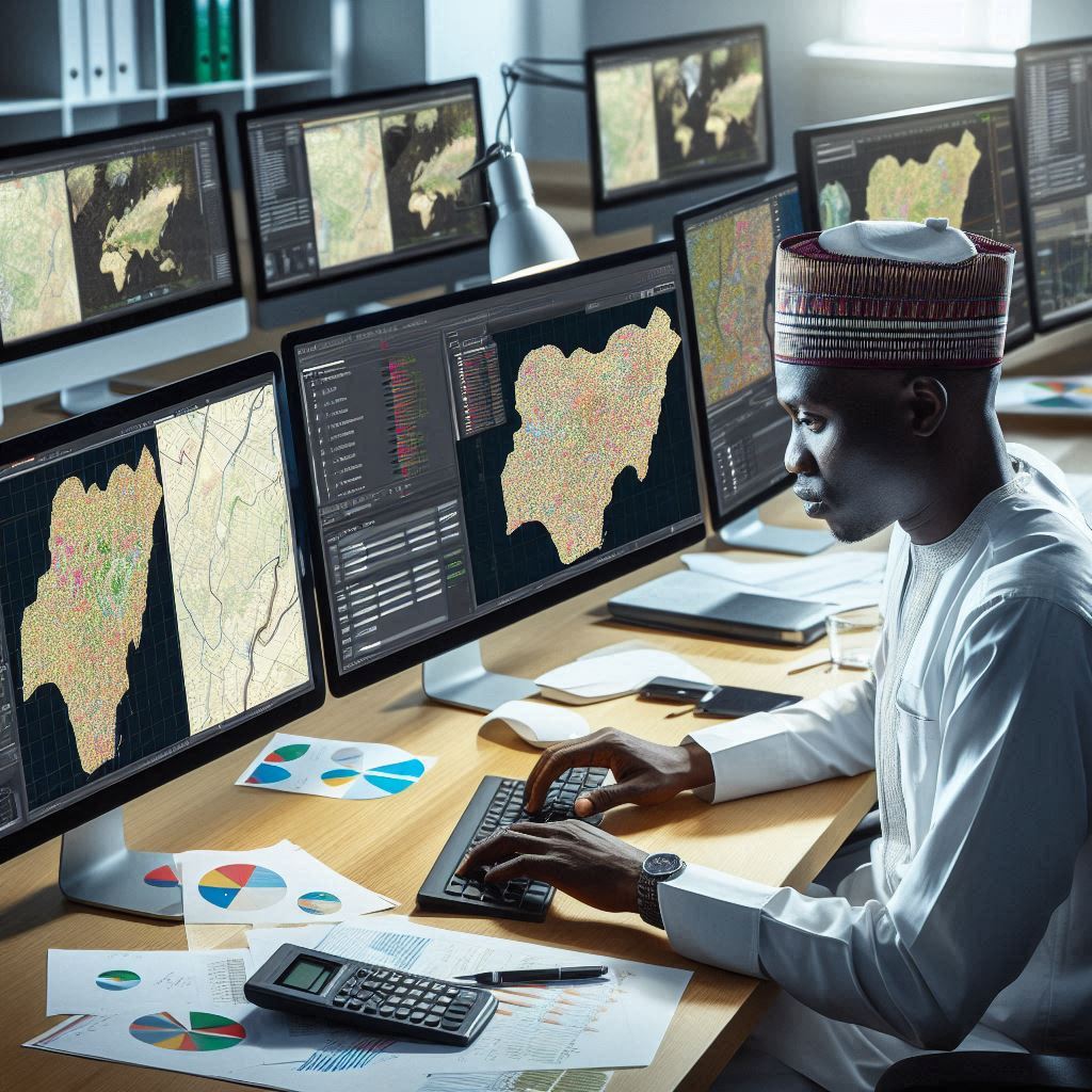
In the modern era, Geographic Information Systems (GIS) and Global Positioning Systems (GPS) have revolutionized the way mapping is done in Nigeria.
GIS technology allows for the collection, storage, analysis, and visualization of spatial data, providing detailed information about the geography of Nigeria.
GPS technology, on the other hand, enables accurate positioning of geographical features in real-time, making it easier to map out different locations across Nigeria.
These two technologies work hand in hand to create comprehensive maps of Nigeria, showcasing its diverse landscapes, infrastructure, and natural resources.
Advantages of digital mapping tools
- Accuracy: Digital mapping tools like GIS and GPS ensure precise mapping of Nigeria, reducing errors and improving data quality.
- Efficiency: These tools enable faster collection and processing of spatial data, helping in the quick creation of maps.
- Visualization: Digital maps provide a clear visual representation of Nigeria’s geography, making it easier to understand and analyze spatial information.
- Accessibility: With digital mapping tools, maps can be easily shared, accessed, and updated, allowing for better collaboration among users.
- Integration: GIS and GPS can be integrated with various data sources, allowing for a more comprehensive understanding of Nigeria’s geography.
Challenges in implementing modern mapping technologies
- Cost: Acquiring and maintaining GIS and GPS equipment can be expensive, limiting access to these technologies in Nigeria.
- Technical Expertise: Proper training is essential for using digital mapping tools effectively, but there is a shortage of skilled professionals in Nigeria.
- Infrastructure: Limited internet connectivity and inadequate power supply can hinder the implementation of modern mapping technologies in Nigeria.
- Data Quality: Ensuring the accuracy and reliability of data collected through GIS and GPS can be challenging, affecting the overall quality of maps.
- Legal and Ethical Issues: There may be legal restrictions on mapping certain areas in Nigeria, leading to limitations in data collection and analysis.
Generally, while modern mapping technologies have greatly improved the mapping of Nigeria, there are still challenges that need to be addressed to fully harness their potential.
With proper investment, training, and infrastructure development, Nigeria can leverage GIS and GPS to create comprehensive and accurate maps for various purposes.
Read: Role of GIS in Nigerian Urban Planning
Regional Variations in Mapping
Mapping Nigeria presents a diverse tapestry where regional variations unfold distinctly. Northern Nigeria, characterized by its arid terrain and savannah landscapes, contrasts sharply with the lush, tropical South.
Maps vividly illustrate this dichotomy, with northern regions marked by sparse settlements and vast expanses of desert hues.
In contrast, southern maps reveal dense networks of rivers and forests, reflecting its vibrant ecology and higher population densities.
Contrasting Maps of Northern and Southern Nigeria
Northern Nigeria’s maps often emphasize administrative boundaries and land use patterns crucial for agrarian communities. Here, cartographers highlight key infrastructures like irrigation systems and pastoral routes crucial for nomadic tribes.
In contrast, maps of the South intricately detail coastal features, mangrove swamps, and urban agglomerations. These maps are vital for managing densely populated cities and preserving delicate ecosystems.
Mapping of Urban vs Rural Areas
Urban maps of Nigerian cities showcase bustling metropolises like Lagos and Abuja, highlighting transportation networks, commercial hubs, and residential zones.
These maps are pivotal for urban planning, resource allocation, and disaster management.
Conversely, rural mapping focuses on agrarian lands, livestock corridors, and village settlements crucial for agricultural productivity and community development.
Such maps aid in rural infrastructure development and socio-economic policies.
Mapping of Natural Resources and Infrastructure
Nigeria’s maps of natural resources delineate vast reserves of crude oil in the Niger Delta and mineral deposits across the country. These maps guide resource extraction, environmental conservation efforts, and regional economic policies.
Furthermore, infrastructure mapping outlines transport arteries such as highways and railways, essential for national connectivity and economic growth.
These maps inform infrastructure investments, logistics planning, and disaster response strategies.
In essence, Mapping Nigeria transcends mere cartography; it’s a narrative of diverse landscapes, socio-economic disparities, and environmental stewardship.
From the arid expanses of the North to the verdant South, each map tells a story of adaptation, resource management, and community resilience.
Whether mapping urban complexities or rural dynamics, each region’s distinct needs and potentials emerge vividly through cartographic lenses.
As Nigeria navigates its developmental journey, these maps serve as indispensable tools for informed decision-making and inclusive growth.
In summary, the art of mapping Nigeria is not just about lines on paper; it’s about understanding the pulse of a nation, revealing its challenges and potentials through the lens of geography and data.
Read: Impact of GIS on Nigerian Environment

Cultural Significance of Maps
Maps in Nigeria serve not just as navigational tools but as cultural artifacts, embodying the rich tapestry of traditions and histories woven across its diverse landscapes.
These maps intricately detail the nuances of various ethnic groups, reflecting their unique customs, languages, and belief systems. Each cartographic representation is a testament to the cultural mosaic that defines Nigeria.
Role of Maps in Preserving Cultural Heritage
Preservation of Nigeria’s cultural heritage finds a steadfast ally in maps. By delineating traditional territories and landmarks, maps safeguard ancestral knowledge and sacred sites.
They encapsulate the spatial relationships integral to rituals, ceremonies, and communal practices, ensuring these traditions endure through generations.
Maps thus become repositories of intangible cultural heritage, offering insights into the profound connections between people and their land.
Mapping of Traditional Territories and Landmarks
The meticulous mapping of Nigeria’s traditional territories and landmarks is a painstaking endeavor steeped in historical reverence.
From ancient kingdoms to contemporary settlements, each boundary marked on these maps echoes narratives of resilience and adaptation.
These cartographic depictions not only demarcate geographical boundaries but also trace the evolution of societies, illustrating shifts in power dynamics and the interplay of cultural influences over centuries.
Use of Maps in Storytelling and Folklore
In Nigeria, maps transcend their utilitarian purpose to become conduits of storytelling and folklore. They narrate the journeys of mythical heroes, chart the paths of legendary migrations, and unveil the origins of sacred symbols.
Embedded within these maps are tales of triumph and tragedy, each contour and annotation weaving a narrative thread that binds past with present.
Through maps, oral traditions find visual expression, enriching cultural narratives with spatial context.
In a nutshell, Mapping Nigeria is more than a cartographic exercise; it is a journey through time and culture, navigating the complexities of identity and belonging.
As these maps unfold, they unveil the layers of Nigeria’s cultural landscape, revealing a tapestry woven from countless threads of tradition and heritage.
They serve not just as guides through physical terrain but as windows into the soul of a nation, where stories are etched into the very contours of the land.
In essence, the cultural significance of maps in Nigeria lies not merely in their practical applications but in their profound ability to preserve, portray, and perpetuate the essence of a people.
They are, in essence, cultural artifacts that bridge past and present, embodying the spirit of a nation shaped by its diverse histories and enduring traditions.
Transform Your Career with Expert Guidance
Get personalized mentorship consulting that’s tailored to your unique path. Our expert advice is actionable and exclusive.
Get StartedRead: GIS Technology Advancements in Nigeria
Mapping for Development
Mapping plays a pivotal role in driving development across Nigeria. By accurately charting urban areas, rural landscapes, and natural resources, maps become indispensable tools.
They provide a clear view of infrastructure needs, population distribution, and economic activities. This data is crucial for making informed decisions that spur growth and improve living standards.
Importance of Accurate Maps for Urban Planning
In urban planning, precise maps are essential for laying out infrastructure such as roads, utilities, and housing. They enable city planners to anticipate future needs based on population trends and economic forecasts.
Accurate mapping helps in zoning regulations, ensuring that residential, commercial, and industrial areas are appropriately designated.
This prevents overcrowding, promotes efficient land use, and enhances overall urban livability.
Mapping for Disaster Response and Prevention
During disasters, whether natural or man-made, detailed maps are invaluable for swift response and effective mitigation strategies. Precise mapping of vulnerable areas helps identify risks like flood zones, fault lines, or areas prone to erosion.
Emergency services rely on these maps to evacuate residents, deploy resources, and coordinate rescue operations.
Furthermore, accurate maps aid in planning resilient infrastructure that can withstand disasters, minimizing damage and saving lives.
Mapping for Conservation and Sustainable Development
Conservation efforts are greatly bolstered by mapping natural habitats, biodiversity hotspots, and protected areas.
These maps guide conservationists in monitoring wildlife populations, identifying threats, and planning strategies for habitat restoration.
They also support sustainable development by mapping renewable energy potential, water resources, and agricultural zones.
This enables policymakers to balance economic growth with environmental conservation, ensuring long-term prosperity without compromising natural ecosystems.
Each of these aspects highlights how mapping isn’t merely about drawing lines on paper or screens; it’s about empowering decision-makers with actionable data.
The accuracy and comprehensiveness of maps directly influence the effectiveness of policies and interventions.
As technology advances, so does the precision of mapping techniques, allowing for more detailed and insightful representations of Nigeria’s diverse landscapes and urban environments.
In review, the journey of mapping Nigeria is one of continuous improvement and application across various sectors.
From urban planning to disaster response, conservation efforts to sustainable development, accurate maps serve as foundational tools for progress.
They bridge the gap between knowledge and action, fostering a future where Nigeria can thrive economically, environmentally, and socially.
Embracing the power of mapping ensures that Nigeria moves forward with resilience and foresight, prepared for whatever challenges and opportunities lie ahead.
Challenges in Mapping Nigeria
Mapping Nigeria presents a myriad of challenges that span from data accuracy to political influences and issues of accessibility and literacy.
Lack of Accurate Data and Survey Information
In Nigeria, the challenge of mapping begins with the fundamental issue of data accuracy. Many regions lack up-to-date surveys and detailed geographic information.
This absence hampers efforts to create reliable maps that can guide development projects and public services effectively.
Moreover, the rapid urbanization and changing landscapes further complicate the task.
Urban areas, especially informal settlements, often grow faster than data can be collected, leading to outdated maps that do not reflect the current state of the environment.
Political Influence on Mapping Practices
Political factors also heavily influence mapping practices in Nigeria. Government agencies often control mapping initiatives, which can lead to biases or selective dissemination of geographic information.
This control can hinder transparency and accuracy, as maps may be altered to suit political agendas rather than reflect objective geographical realities.
Additionally, in regions where political tensions are high, access to certain areas for mapping purposes may be restricted or prohibited altogether.
This limitation not only affects the accuracy of maps but also impedes efforts to monitor and manage resources effectively.
Issues of Accessibility and Literacy in Map Usage
Another significant challenge in mapping Nigeria revolves around accessibility and literacy in map usage.
While digital mapping technologies have advanced, a large portion of the population, especially in rural areas, lacks access to the internet and digital devices.
This digital divide limits the reach and usefulness of online maps for everyday decision-making and planning.
Moreover, literacy levels play a crucial role in the effective use of maps. Illiteracy rates in Nigeria pose a barrier to understanding and interpreting spatial information presented on maps.
Without adequate literacy, communities may struggle to benefit from the insights that maps can provide for disaster response, infrastructure planning, and public health initiatives.
In fact, Mapping Nigeria is not just a technical endeavor but a complex interplay of factors that influence how accurately and effectively geographical information can be represented and utilized.
Addressing these challenges requires collaborative efforts between government agencies, civil society organizations, and technology providers to improve data collection methods,
ensure transparency in mapping practices, and enhance accessibility and literacy in map usage across all sectors of society.
By overcoming these challenges, Nigeria can harness the power of accurate mapping to foster sustainable development, equitable resource distribution, and informed decision-making at all levels of governance and community engagement.
Conclusion
Mapping Nigeria has unveiled a tapestry of diversity and unity, offering a profound glimpse into its geographical and cultural richness.
Recap of the Importance of Mapping Nigeria
Accurate mapping is more than geography; it’s a key to understanding resources, demographics, and developmental needs.
Mapping initiatives like the Nigerian Mapping Agency’s efforts showcase the pivotal role of maps in national planning and development.
Call to Action for Better Mapping Practices
To enhance accuracy and relevance, stakeholders must invest in updated technology and community engagement for comprehensive mapping.
Collaborative efforts between government bodies, NGOs, and local communities can ensure inclusive and detailed mapping across Nigeria’s vast landscapes.
Potential for Using Mapping to Bridge Cultural Divides and Promote National Unity
Maps not only delineate borders but also connect people through shared understanding of history, environment, and resources.
By incorporating indigenous knowledge and local perspectives, mapping can preserve cultural heritage while promoting national cohesion.
Mapping initiatives can bridge urban-rural divides by highlighting infrastructure needs and ensuring equitable development.
Embracing Technological Advances for a Unified Nigeria
Digital mapping tools offer real-time data, empowering decision-makers to respond swiftly to crises and long-term developmental goals.
Public access to mapping data fosters transparency and accountability in governance, empowering citizens to participate in national development.
Towards a Mapped and Unified Future
As we conclude this cartographic journey through Nigeria, the importance of mapping cannot be overstated.
From fostering national unity to guiding sustainable development, mapping is a cornerstone of Nigeria’s journey towards prosperity and inclusivity.
Let us embrace the call to action for better mapping practices, ensuring that every Nigerian’s voice and landscape is accurately represented.
Through mapping, we can celebrate diversity, bridge divides, and build a future where every corner of Nigeria thrives in unity and understanding.