




Choosing soil data for Nigerian research begins with the decision you want to support. A national comparison, a classroom mapping exercise and a field-specific fertilizer recommendation demand different evidence. An attractive map or a large continental dataset does not establish suitability for all three.
This guide helps soil-science, agronomy, GIS and environmental students audit a dataset before mapping. We separate the latest Nigerian soil-science discussion from an earlier data release, explain its counting units, and provide five figures plus two reusable CSV tools. Our contribution is a reproducible suitability framework, not a new map of Nigerian soil conditions.
Research check: 28 October 2026. No Nigeria-specific dataset extraction was completed for this article. We publish no Nigerian sample total, state average, nutrient-deficiency percentage, fertilizer prescription or measured yield improvement. Keep that boundary visible when using the resources in a dissertation or seminar.
Why soil data for Nigerian research needs a decision first
An IITA report published through CGIAR on 27 October 2026 describes its contribution to the Soil Science Society of Nigeria’s 50th annual conference. The discussion connects continental soil evidence with Nigerian decisions. We use that publication as the timely starting point, without treating its date as the conference date or a new dataset release.
Write your intended claim before selecting a file. Specify the geography, population or land area, property, depth and time period. Then identify the decision the result might inform. This makes it easier to reject an unsuitable product before investing time in styling a map.
For example, describing a documented continental release is different from estimating a Nigerian national distribution. Both differ from advising on a named field. The last task needs evidence appropriate to that site and decision. A national-scale product cannot acquire field-level validity simply by zooming in.
What the October soil-property release actually describes
The ISRIC announcement dated 5 October 2026 describes estimates of 19 soil properties derived from mid-infrared, or MIR, spectra. It covers more than 11,000 samples from over 6,100 locations across 21 African countries. These are continental coverage statements, with qualifiers that must be retained.
| Reported value | Unit | Interpretation check |
|---|---|---|
| 19 | Estimated properties | Variables, not independent sites |
| More than 11,000 | Soil samples | Not a Nigerian or farm count |
| Over 6,100 | Locations | Different depths can share a location |
| 21 | Countries | Released property-data coverage |
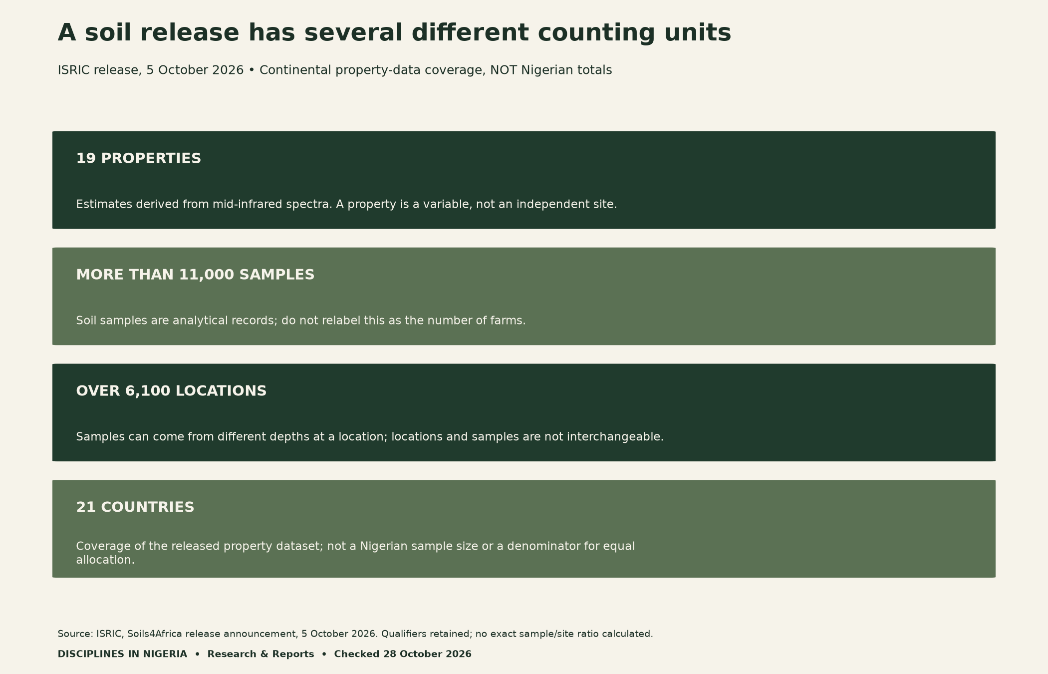
A sample is not necessarily a unique location. Several depth records may relate to one site, while several properties may describe one sample. Before calculating a denominator, inspect the identifiers and relationships in the selected product. Counting spreadsheet rows without understanding those relationships can inflate an apparent sample size.
Keep product coverage separate from project coverage
The announcement also describes a wider sampling campaign spanning more than 13,000 locations in 33 countries, with analysis and quality control continuing. That broader campaign is not identical to the released property dataset. Do not combine their totals or infer a precise completion percentage from the rounded figures.
A separate Zenodo field-observation record, version 1, was published on 26 June 2026. Its description refers to over 15,000 field locations in 33 countries and warns that quality control is ongoing. Its DOI is 10.5281/zenodo.17699297. A field-observation product and a property-estimate release need separate identities and metadata.
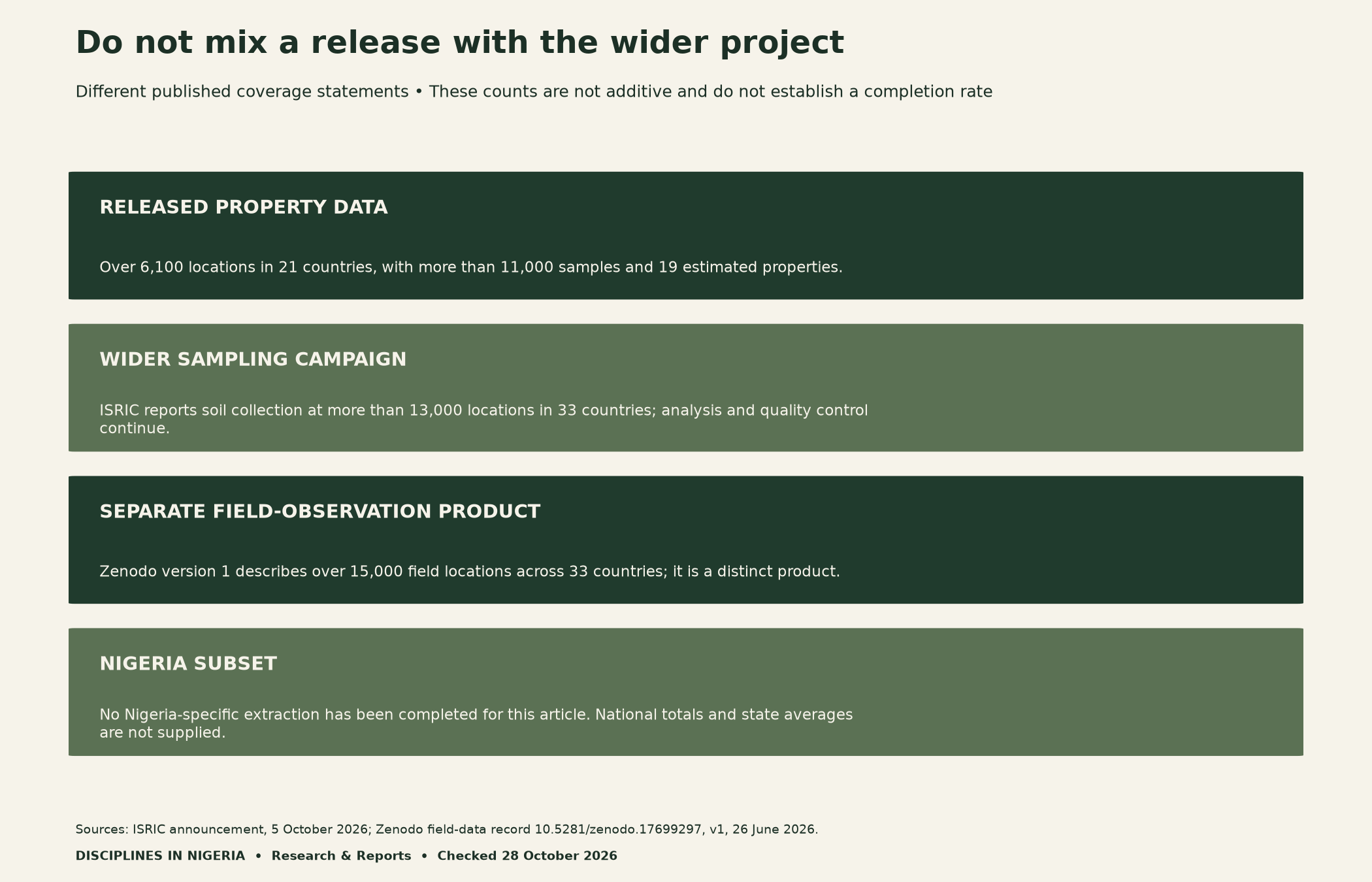
For your own audit, keep one record per exact product version. Save its title, DOI or stable URL, publication date and access date. Also record the collection period if supplied. A news announcement, repository release and fieldwork period answer different timing questions.
Match soil data for Nigerian research to its intended scale
The Soil Data of Africa portal recommends national-to-continental application and discourages subnational use, particularly at field level. That warning should shape the research question before analysis begins. It is not a minor detail to hide beneath a polished map.
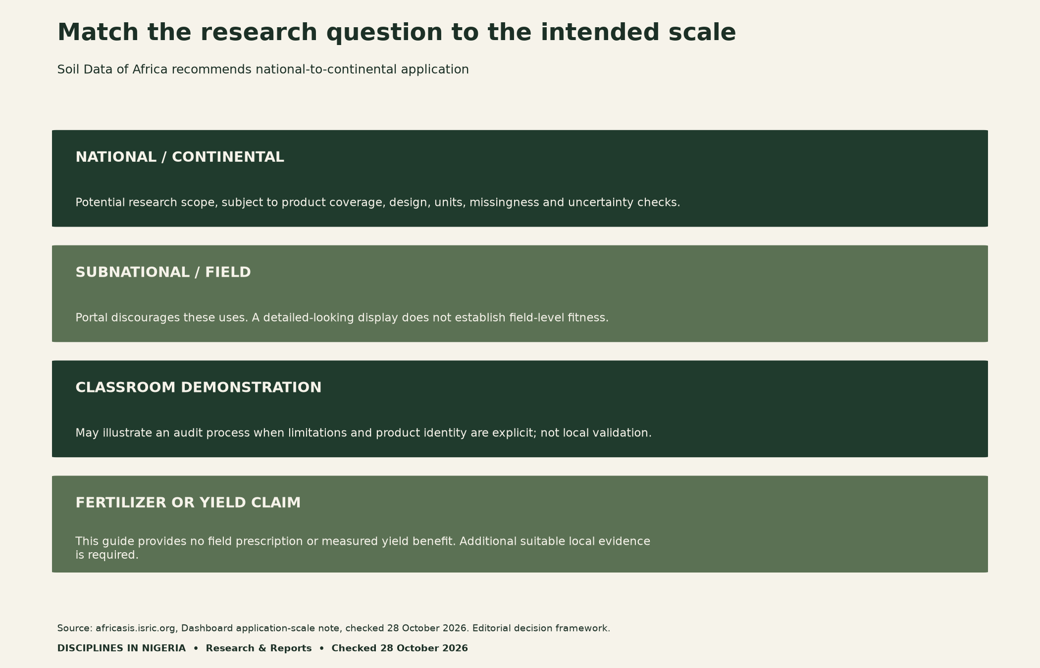
National scope still requires a suitable sampling design, relevant coverage and defensible measurement. Country inclusion alone does not prove national representativeness. Similarly, a dense-looking map may conceal missing records, uneven coverage or uncertain predictions. Explain which of those issues you can check and which remain unresolved.
When presenting a classroom map, state its educational purpose and cite the exact product. Avoid labelling it a validated field assessment. Displaying smaller pixels or adding state boundaries changes the presentation; it does not create new observations or improve the underlying evidence.

Audit soil measurements, depths and missing values
For each property, record the unit and analytical method. Preserve whether the value is directly measured or estimated through a model. ISRIC describes the October property estimates as MIR-derived. Do not silently relabel those estimates as direct laboratory measurements of every listed property.
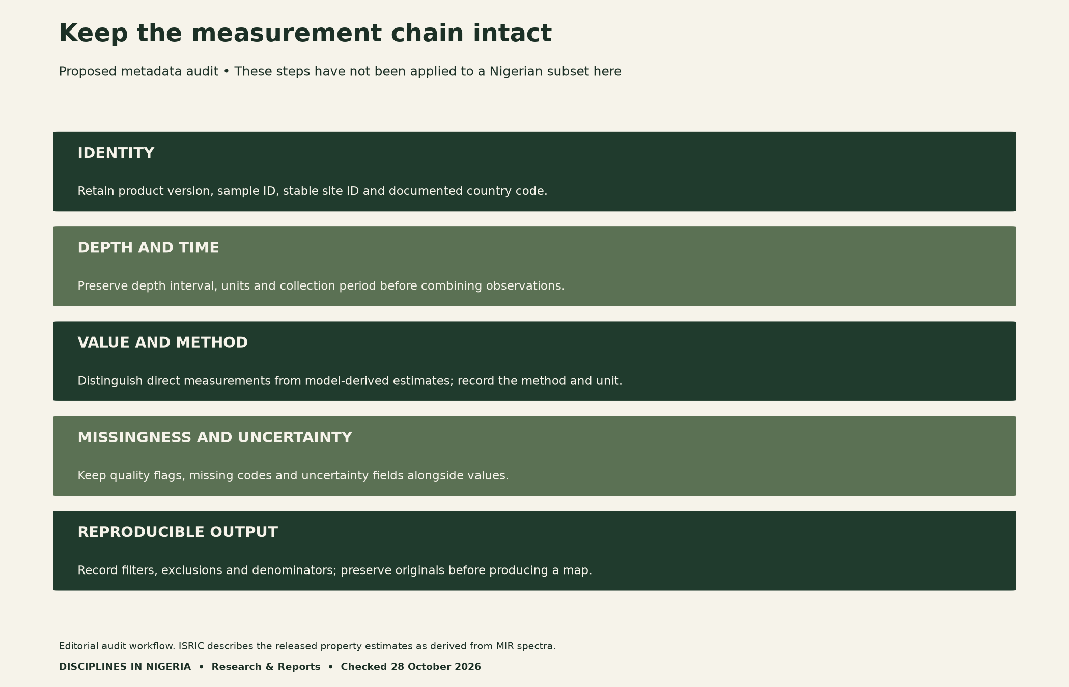
Next, inspect depth intervals before combining records. A surface observation and a deeper sample do not necessarily describe the same target. If intervals differ, explain your harmonisation method and its assumptions. Do not average incompatible records merely because they share a country code.
Also distinguish missing data from true zero. Read the product’s missing-value codes and quality flags before computing summaries. Retain uncertainty fields where available, and document any exclusions. A clean-looking result can be misleading if the cleaning rule quietly removes the least certain observations.
A proposed workflow for a Nigerian subset
Begin with the selected product’s documentation and verify its Nigerian records using the documented country identifiers. Then separate unique sites, samples and depth records with stable keys. Only after those checks should you consider summaries that match the sampling design and intended scale.
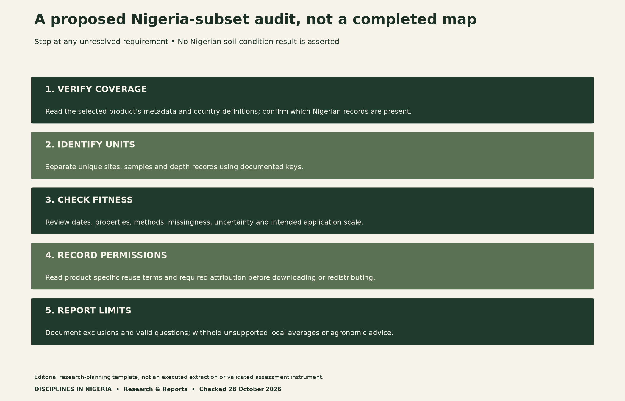
Check the reuse terms for the exact product before downloading, redistributing or adapting it. The portal points to a data-licence agreement, while catalogue products can have their own terms. Record required attribution and version information. An accessible download button is not a complete description of permitted reuse.
Finally, retain the original file and an exclusion log. Record the input version, filters, variable definitions, units, row counts and output date. Someone else should be able to follow the same choices. If an assumption changes, create a dated revision rather than overwriting the earlier result without explanation.
Methods, limits and reusable audit tools
Our soil data for Nigerian research guide compares published metadata and application-scale guidance. We inspected the source pages but did not download or analyse the underlying soil datasets. Consequently, the diagrams are evidence cards and editorial audit frameworks, not a completed national assessment or an endorsement of a particular product for your project.
The same evidence discipline appears in our economic-impact assumption audit: reproducing a calculation is separate from validating its inputs. Before collecting additional local data, use our research-readiness checklist to discuss facilities, permissions and data stewardship with your supervisor.
Download the soil-release evidence card (CSV): four reported coverage measures with units, qualifiers, source URL and release date. These are metadata, not soil observations.
Get the blank dataset-suitability worksheet (CSV): twelve proposed audit prompts with empty evidence and notes fields. It is an editorial planning tool, not a completed or validated assessment.
Suggested citation: Naija Scholar, Disciplines In Nigeria (28 October 2026), “Using Soil Data for Nigerian Research: How to Check Scale, Coverage and Measurement Before Mapping.” Credit IITA, ISRIC and the dataset creators separately for their source material. Cite this guide for the editorial framework and worksheet.


