Introduction
Land surveying and geoinformatics are essential disciplines that play a crucial role in various industries.
Brief Overview of Land Surveying and Geoinformatics
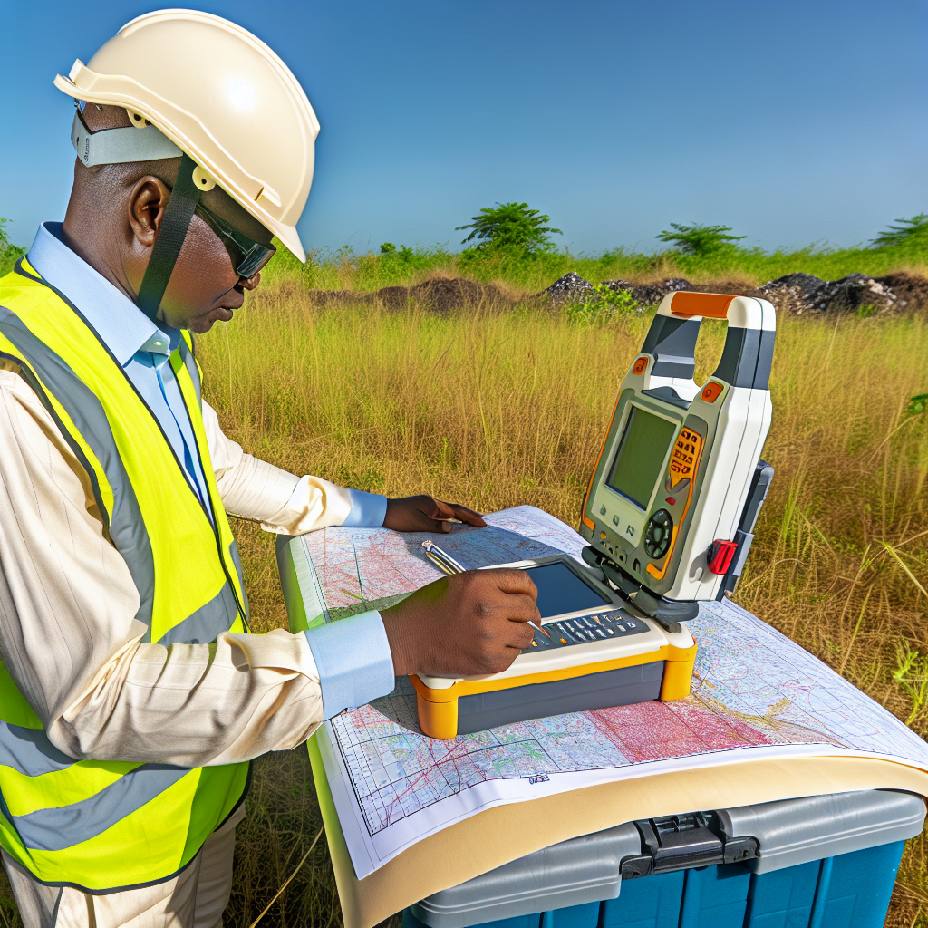
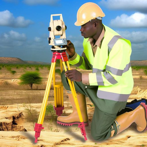
Land surveying involves measuring and mapping the earth’s surface to determine boundaries, elevations, and distances.
Geoinformatics, on the other hand, focuses on the collection, analysis, and visualization of geographical data using technology.
Importance of These Disciplines in Various Industries
In the construction industry, land surveyors provide accurate data for site planning and building infrastructure.
In agriculture, geoinformatics help optimize crop yields through precision farming techniques based on spatial data analysis.
Urban planning relies on land surveying to develop sustainable cities and manage natural resources efficiently.
Environmental conservation efforts benefit from geoinformatics by monitoring and analyzing land use changes to protect ecosystems.
Current trends in land surveying and geoinformatics
There has been a shift towards using advanced technology in land surveying and geoinformatics.
New methods and tools are being integrated to improve accuracy and efficiency in data collection.
The industry is moving towards digital mapping and analysis for better decision-making processes.
Use of drones for mapping and data collection
Drones have revolutionized the way land surveying is done by providing aerial imagery.
They are used for mapping large areas quickly and efficiently, saving time and resources.
Drones can capture high-resolution images and data, which can be used for creating 3D models.
They are also being used for monitoring land changes, vegetation mapping, and disaster response.
Integration of GIS technology for analysis and decision-making
Geographic Information Systems (GIS) technology has become essential in land surveying.
GIS helps in analyzing spatial data, creating maps, and making informed decisions.
It allows surveyors to overlay different layers of data to gain valuable insights.
GIS technology is used in urban planning, natural resource management, and environmental monitoring.
Adoption of advanced surveying equipment for accuracy
Surveyors are increasingly using advanced equipment like Total Stations and GPS devices.
These tools provide precise measurements and accurate positioning for surveying purposes.
Advanced surveying equipment helps in reducing errors and improving overall project quality.
Improved accuracy leads to better decision-making and successful completion of projects.
The future trends in land surveying and geoinformatics point towards the use of advanced technology for accurate data collection, analysis, and decision-making.
The integration of drones, GIS technology, and advanced surveying equipment will continue to enhance the efficiency and effectiveness of land surveying practices in the years to come.
Emerging technologies in the field
Land surveying and geoinformatics have been greatly influenced by emerging technologies in recent years.
These technologies have not only enhanced the efficiency and accuracy of data collection but have also revolutionized the entire process.
Artificial intelligence and machine learning in data processing
One of the most significant advancements in land surveying is the incorporation of artificial intelligence (AI) and machine learning in data processing.
These technologies have the capability to analyze vast amounts of data quickly and accurately, leading to more precise results.
Virtual reality and augmented reality for visualization
Virtual reality (VR) and augmented reality (AR) are being increasingly used in land surveying for visualization purposes.
These technologies allow surveyors to create immersive and interactive 3D models of the surveyed area, providing a better understanding of the terrain and features.
Blockchain technology for secure land transactions
Blockchain technology has brought a new level of security and transparency to land transactions.
By utilizing blockchain, land surveyors can ensure that property records are tamper-proof and securely stored, reducing the risk of fraud and disputes.
These emerging technologies are reshaping the future of land surveying and geoinformatics, making the process more efficient, accurate, and secure.
Surveyors who embrace these technologies will undoubtedly gain a competitive edge in the industry.
Explore Further: Land Surveying and Environmental Management
Environmental challenges and the role of land surveying
Land surveyors play a vital role in assessing and monitoring the impact of human activities on the environment.
They utilize advanced technologies such as Geographic Information Systems (GIS) and remote sensing to collect data and analyze land use patterns.
Monitoring and managing natural resources
Land surveyors help in the efficient management of natural resources by providing accurate measurements of land areas and boundaries.
This information is essential for creating land management plans and conservation strategies.
Mitigating the impact of climate change on land use
With the increasing threat of climate change, land surveyors are essential in identifying vulnerable areas and developing strategies to adapt to changing environmental conditions.
Transform Your Career with Expert Guidance
Get personalized mentorship consulting that’s tailored to your unique path. Our expert advice is actionable and exclusive.
Get StartedBy mapping out flood zones and erosion-prone areas, they help in planning for sustainable land use practices.
Ensuring sustainable development practices
Land surveying plays a key role in promoting sustainable development by providing accurate data on land use and resources.
This information is crucial for making informed decisions about urban planning, infrastructure development, and natural resource management.
The importance of land surveying in sustainability
Land surveying and geoinformatics are essential tools in addressing environmental challenges and ensuring sustainable development practices.
By utilizing advanced technologies and techniques, land surveyors play a crucial role in monitoring and managing natural resources, mitigating the impact of climate change, and promoting sustainable land use practices.
Find Out More: How to Become a Biomedical Engineer in Nigeria
Future job prospects and skills needed
The field of land surveying and geoinformatics is evolving rapidly.
New job opportunities are emerging for skilled professionals.
To excel in this field, individuals must possess a strong foundation in surveying techniques.
Geospatial data analysis and geographic information systems (GIS) are also vital.
Employers are looking for professionals with expertise in remote sensing, drone technology, and 3D modeling.
Demand for skilled professionals in surveying and geoinformatics
As the world becomes more interconnected, the demand for skilled surveyors is on the rise.
Industries such as construction, urban planning, and natural resource management rely on accurate land surveys.
Disaster response also depends on geospatial information to make informed decisions.
This growing demand presents exciting career opportunities for individuals looking to enter the field.
Importance of continuous learning and adaptability to new technologies
Advancements in technology require professionals to prioritize continuous learning.
Embracing new tools and software is essential in the field of surveying and geoinformatics.
Staying up-to-date with industry trends enhances job performance.
It also opens up new opportunities for career growth.
Professionals should embrace emerging technologies such as artificial intelligence and cloud computing.
Collaboration with other disciplines such as urban planning and environmental science
Surveyors often collaborate with experts from other disciplines.
Collaboration helps to address complex spatial challenges effectively.
By working together, professionals create holistic solutions that benefit communities.
Cross-disciplinary collaboration fosters innovation and creativity in the field.
Find Out More: Innovative Surveying Methods for Nigerian Landscapes

Role of government and regulations
The government plays a crucial role in land surveying and geoinformatics by setting guidelines and regulations.
These regulations ensure that land surveyors adhere to professional standards and maintain accuracy in their work.
Government bodies also oversee the licensing and certification of land surveyors to guarantee competency and reliability.
Regulations help in preventing land disputes, ensuring proper land use planning and development, and protecting property rights.
Policies and standards for land surveying and geoinformatics
Various policies and standards are in place to govern the practice of land surveying and geoinformatics.
These policies define the procedures, methodologies, and ethical considerations that surveyors must follow.
Standards for data collection, analysis, and reporting help in maintaining consistency and accuracy in survey results.
Adhering to these policies and standards is essential in upholding the quality and integrity of surveying practices.
Compliance with legal requirements for land use planning
Land surveyors must comply with legal requirements to ensure that land use planning is conducted lawfully.
By following zoning laws, environmental regulations, and building codes, surveyors contribute to sustainable development.
Compliance with legal requirements also helps in mitigating potential risks and liabilities associated with land use projects.
Surveyors play a pivotal role in ensuring that land use planning aligns with the broader goals of urban and rural development.
Importance of data privacy and security in geospatial information
Protecting data privacy and security is paramount in the field of geoinformatics.
Geospatial information often contains sensitive data that must be safeguarded from unauthorized access or misuse.
Implementing robust data encryption, access controls, and secure storage systems is essential to prevent data breaches.
Maintaining data privacy and security instills trust in stakeholders and ensures the confidentiality of geospatial information.
Delve into the Subject: Collaboration Opportunities in Nigerian Biomedical Engineering
Future Trends in Land Surveying and Geoinformatics
As we have highlighted in this blog post, the future trends in land surveying and geoinformatics are evolving rapidly.
It is essential for professionals in this field to stay updated with these advancements to ensure success.
Recap of Key Points Discussed
We have discussed the incorporation of drones, AI, and 3D modeling in land surveying, which are shaping the future of the industry.
Additionally, the importance of data accuracy and integration with GIS technology was emphasized.
Importance of Staying Updated
Staying abreast of the latest technologies and methodologies in land surveying and geoinformatics is crucial for professionals.
This knowledge helps professionals remain competitive and provide high-quality services.
By embracing these future trends, professionals can enhance their efficiency, accuracy, and overall effectiveness in their work.
Additional Resources
new training mandates for surveying and geoinformatics institutions …
[E-Books for Sale]
The Nigerian Professional's Playbook: Strategies to Accelerate Your Career and Build Lasting Wealth
₦2,000 • 10 Chapters • 33 pages
Fed Up with Stagnant Salaries and Career Frustration? Grab the Proven Nigerian Playbook for Just ₦2,000!
See All 10 Chapters of this E-Book
500 Cutting-Edge Tech Startup Ideas for 2024 & 2025: Innovate, Create, Dominate
₦3,000 • 500 Tech Startup Ideas • 62 pages
You will get inspired with 500 innovative tech startup ideas for 2024 and 2025, complete with concise descriptions to help you kickstart your entrepreneurial journey in AI, Blockchain, IoT, Fintech, and AR/VR.
See All 500 Tech Startup Ideas of this E-Book
Mastering Project Management: A Comprehensive Guide to GanttPRO and Microsoft Project
₦3,150 • 10 Chapters • 102 pages
Explore 'Mastering Project Management,' an e-book guide on using GanttPRO and MS Project for optimal project success.
See All 10 Chapters of this E-Book
Migration Mastery: From Nigeria to Abroad
₦2,450 • 30 Chapters • 244 pages
Unlock success in your migration from Nigeria with our e-book. Comprehensive guide for a smooth transition abroad.
See All 30 Chapters of this E-Book
The Future of Work in Nigeria: Trends, Professions, and Possibilities
₦3,500 • 24 Chapters • 188 pages
Navigate Nigeria's evolving job landscape with our e-book on the future of work. Gain key insights into tech innovations and cultural shifts. Stay ahead; purchase today.
See All 24 Chapters of this E-Book
50 Simple Tips to Stay Ahead of Your Peers
₦1,750 • 5 Chapters • 25 pages
Master success with '50 Simple Tips to Stay Ahead of Your Peers'. Unlock strategies to outshine and excel in every aspect of life.


