Introduction
Cartography in Nigeria has a rich history dating back to pre-colonial times.
Indigenous people created rudimentary maps that depicted trade routes and tribal boundaries.
These early efforts laid the groundwork for more sophisticated cartographic practices.
Colonial rule introduced advanced mapping techniques.
British surveyors extensively mapped Nigeria, aiding in administration and resource management.
Post-independence, Nigerian cartographers took charge, furthering these efforts with enhanced precision and local knowledge.
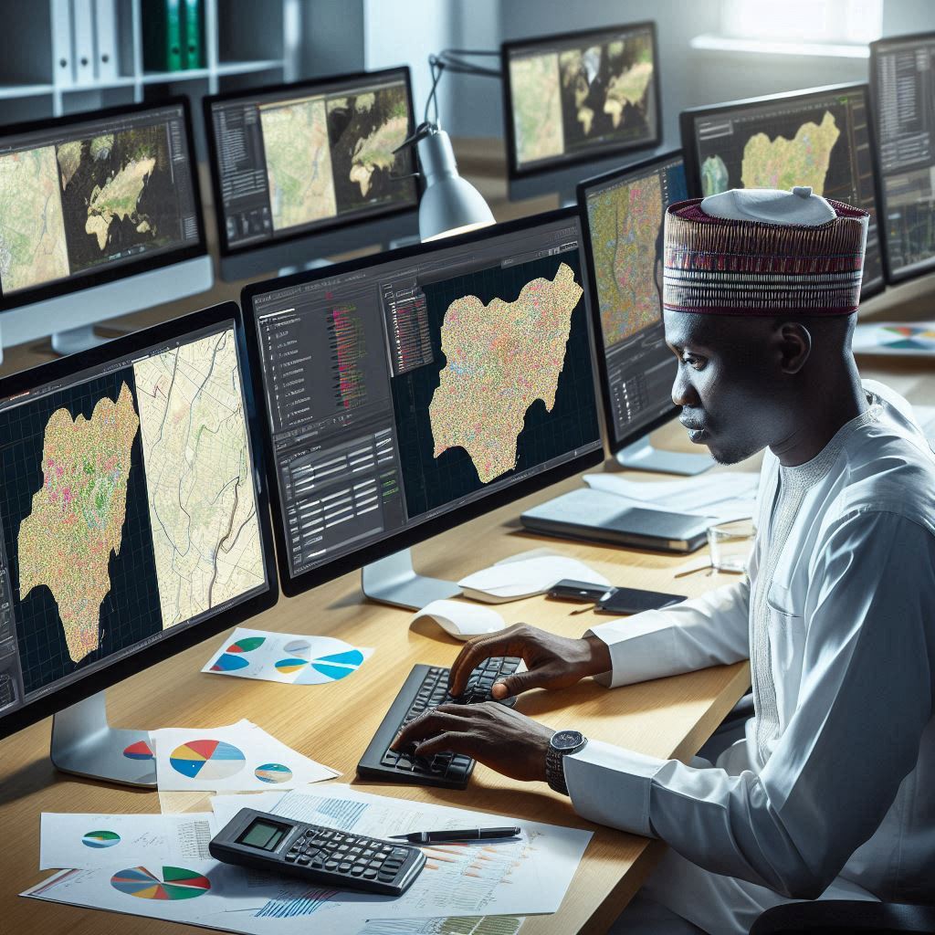
Nigerian cartographers play a crucial role in national development.
They create detailed maps of cities, rural areas, and natural resources, essential for urban planning, agriculture, and infrastructure development.
Accurate maps are invaluable for disaster management and environmental protection, helping to mitigate the impacts of natural calamities and preserve ecosystems.
Additionally, cartography boosts tourism by highlighting attractions, thereby supporting the economy.
Modern Nigerian cartographers use technologies like Geographic Information Systems (GIS) and remote sensing.
These advancements significantly improve map accuracy and accessibility.
Their work ensures that the country’s spatial data remains current, supporting various sectors.
Through their diligent efforts, cartographers contribute significantly to Nigeria’s progress, providing indispensable tools for policy-making and economic growth.
Basically, cartography remains vital for Nigeria’s sustainable development, with cartographers at the forefront of this essential work.
Profile of John Obaje
Background Information on John Obaje
John Obaje, a prominent Nigerian cartographer, has significantly influenced the field of cartography in Nigeria.
Born and raised in Lagos, Obaje developed an early passion for maps.
His fascination with geography and spatial data guided his educational path.
He pursued a degree in Geography at the University of Ibadan, excelling in his studies.
Obaje furthered his education by obtaining a Master’s degree in Geographic Information Systems (GIS) from Ahmadu Bello University.
His academic prowess and dedication to cartography were evident.
He embarked on a career that would shape Nigeria’s cartographic landscape.
Early in his career, Obaje joined the National Space Research and Development Agency (NASRDA).
Here, he played a pivotal role in advancing cartographic research and applications.
Notable Contributions to Cartography in Nigeria
John Obaje’s contributions to cartography are numerous and impactful.
One of his notable achievements is the development of the first comprehensive digital map of Nigeria.
This map revolutionized how spatial data was accessed and utilized.
It improved urban planning, disaster management, and environmental monitoring across Nigeria.
Obaje’s work made cartographic data more accessible to government agencies, researchers, and the public.
Additionally, Obaje spearheaded the integration of remote sensing technology in Nigerian cartography.
He recognized the potential of satellite imagery for accurate mapping and analysis.
Under his leadership, NASRDA launched several projects utilizing satellite data.
These initiatives enhanced the precision and reliability of Nigeria’s maps.
Obaje’s expertise also extended to education and training.
He established cartographic training programs at various universities.
These programs aimed to equip the next generation of Nigerian cartographers with essential skills.
Obaje’s dedication to education has left a lasting legacy in the academic community.
Recognition in the Field of Cartography
In recognition of his outstanding contributions, John Obaje received numerous accolades.
The Nigerian government awarded him the National Order of Merit for Science and Technology.
This prestigious award acknowledged his groundbreaking work in cartography.
Obaje’s achievements also earned him international recognition.
He was invited to speak at global conferences and collaborate with leading cartographic institutions worldwide.
Furthermore, Obaje’s influence reached beyond traditional cartography.
He advocated for the use of GIS in addressing societal challenges.
His projects included mapping disease outbreaks, optimizing agricultural practices, and improving infrastructure development.
Obaje’s innovative applications of cartographic principles demonstrated the versatility of his expertise.
John Obaje’s dedication, innovation, and influence have left an indelible mark on Nigerian cartography.
His work continues to inspire and guide future generations of cartographers.
By transforming how spatial data is accessed and utilized, Obaje has significantly contributed to Nigeria’s development.
His legacy as a pioneer in Nigerian cartography is firmly established, ensuring his place among the most notable figures in the field.
Read: GIS Technology Advancements in Nigeria
Achievements of Sarah Yusuf
Overview of Sarah Yusuf’s Career in Cartography
Sarah Yusuf, a leading Nigerian cartographer, has made significant strides in the field of cartography.
Her journey began in Kaduna, where she developed a passion for maps and spatial data.
She pursued a degree in Geography at the University of Lagos, graduating with honors.
Sarah Yusuf furthered her education with a Master’s degree in Geographic Information Systems (GIS) from the University of Nigeria, Nsukka.
Her academic excellence and passion for cartography became evident early in her career.
She joined the Nigerian Institute of Cartography, where she quickly rose through the ranks.
Sarah’s career took a significant leap when she became the head of the Cartographic Department at NASRDA.
Her leadership and expertise have driven numerous innovative projects.
Her commitment to advancing cartography in Nigeria has been unwavering and impactful.
Notable Projects and Maps Created by Sarah Yusuf
Sarah Yusuf has spearheaded several groundbreaking projects in Nigerian cartography.
One of her most notable achievements is the creation of the first interactive digital map of Nigeria’s road network.
This project revolutionized navigation and transportation planning in Nigeria.
It provided real-time data and significantly improved route optimization and travel safety.
Another significant project led by Sarah was the comprehensive mapping of Nigeria’s biodiversity hotspots.
Using advanced remote sensing technology, she created detailed maps highlighting areas of ecological importance.
These maps have been crucial for conservation efforts and environmental management.
Sarah also played a key role in developing the Urban Growth Monitoring System.
This system uses satellite imagery to track and analyze urban expansion in Nigerian cities.
It has become an essential tool for urban planners and policymakers, helping to manage rapid urbanization effectively.
Moreover, Sarah Yusuf led the team that developed flood risk maps for Nigeria.
These maps have been instrumental in disaster management and mitigation strategies.
They provide critical information for predicting flood-prone areas and planning evacuation routes.
Awards and Recognition Received for Her Work
Sarah Yusuf’s contributions to cartography have earned her numerous accolades.
The Nigerian government awarded her the National Medal of Honor for her outstanding work in geographic information systems.
This prestigious award recognized her innovative contributions to cartography and spatial analysis.
In addition to national recognition, Sarah has received international acclaim.
She won the International Cartographic Association’s Excellence in Cartography Award.
This award celebrated her innovative use of technology and her impactful cartographic projects.
Sarah has also been a keynote speaker at various global conferences on cartography and GIS.
Her insights and expertise have influenced many in the field.
She continues to inspire young cartographers through her dedication and innovative approach.
Sarah Yusuf’s achievements in cartography are remarkable and far-reaching.
Her work has transformed how spatial data is utilized in Nigeria.
She has set a high standard for excellence and innovation in Nigerian cartography.
Her legacy as a pioneer and leader in the field is firmly established.
Read: Cartography and GIS Education in Nigeria
Impact of Ibrahim Ahmed
Ibrahim Ahmed, a notable Nigerian cartographer, has made significant contributions to the field of cartography in Nigeria.
His impact on the mapping industry has been profound, shaping the way maps are created and utilized in the country.
Influence on Cartography in Nigeria
Ibrahim Ahmed’s expertise and leadership have been instrumental in advancing cartography in Nigeria.
By introducing innovative techniques and methodologies, he has helped in the creation of accurate and detailed maps that serve various purposes.
His passion for cartography has inspired a new generation of map-makers in Nigeria, fostering a culture of excellence and precision in map-making.
Through his mentorship and guidance, many aspiring cartographers have honed their skills and contributed to the field.
Development of Mapping Technology
Under Ibrahim Ahmed’s leadership, there have been significant advancements in mapping technology in Nigeria.
He has spearheaded the adoption of modern tools and software that have enhanced the accuracy and efficiency of map-making processes.
By embracing technological innovations, Ibrahim Ahmed has enabled cartographers to create detailed and comprehensive maps that accurately represent the geographical features of Nigeria.
This has been crucial in various industries, including urban planning, agriculture, and environmental management.
Collaborations with International Organizations
Ibrahim Ahmed has played a key role in fostering collaborations with international organizations in the field of map-making.
Through these partnerships, Nigerian cartographers have been able to access state-of-the-art equipment and expertise that have further improved the quality of mapping in the country.
These collaborations have also provided opportunities for knowledge exchange and learning, enabling Nigerian cartographers to stay updated on the latest trends and developments in the field.
By engaging with the global cartography community, Ibrahim Ahmed has helped put Nigeria on the map, figuratively and literally.
Overall, Ibrahim Ahmed’s impact on cartography in Nigeria cannot be overstated.
His contributions have been instrumental in advancing the field, enhancing mapping technology, and promoting international collaborations.
As a notable Nigerian cartographer, Ibrahim Ahmed continues to inspire and lead the way for future generations of map-makers in the country.
Read: GIS Technology Advancements in Nigeria

Challenges faced by Nigerian cartographers
Despite the important work they do, Nigerian cartographers face several challenges that hinder their ability to create accurate and detailed maps. These challenges range from lack of funding to limited access to advanced mapping tools.
Lack of Funding for Cartography Projects
One of the main challenges that Nigerian cartographers face is the lack of funding for their projects.
Cartography requires specialized equipment, software, and expertise, all of which come at a cost.
Without adequate funding, cartographers struggle to produce high-quality maps that meet international standards.
In many cases, cartographers have to rely on outdated technology and methods due to budget constraints.
This can result in maps that are less accurate and detailed than they could be with proper funding.
Additionally, limited funding means cartographers may not be able to dedicate as much time and resources to their projects, further compromising the quality of their work.
Limited Access to Advanced Mapping Tools
Another challenge faced by Nigerian cartographers is limited access to advanced mapping tools.
Cartography has become increasingly complex in recent years, with the advent of Geographic Information Systems (GIS) and other sophisticated technologies.
However, many cartographers in Nigeria do not have access to these tools, either due to cost or lack of training.
Without access to advanced mapping tools, cartographers are unable to take full advantage of the latest developments in the field.
This can limit their ability to create accurate, up-to-date maps that reflect the ever-changing landscape of Nigeria.
In order to overcome this challenge, cartographers need greater support in terms of training and access to technology.
Need for More Recognition and Support for Cartographers
Finally, Nigerian cartographers often face a lack of recognition and support for their work.
Cartography is a specialized field that requires a unique set of skills and knowledge, yet many people do not fully appreciate the importance of mapping in various aspects of society.
As a result, cartographers may not receive the recognition and support they deserve.
Without recognition and support, cartographers may struggle to attract funding for their projects or gain the attention of decision-makers who could benefit from their work.
Additionally, a lack of awareness about the role of cartographers in society can lead to misconceptions about the value of their work.
To address this challenge, it is important to raise awareness about the importance of cartography and the contributions that cartographers make to society.
Generally, Nigerian cartographers face several challenges that can impact their ability to create accurate and detailed maps.
From lack of funding to limited access to advanced mapping tools, these challenges underscore the need for greater support and recognition for cartographers in Nigeria.
By addressing these issues, Nigerian cartographers can continue to produce high-quality maps that benefit society as a whole.
Read: Impact of GIS on Nigerian Environment
Strategies for Promoting Cartography in Nigeria
Importance of Education and Training for Aspiring Cartographers
Education and training form the bedrock of promoting cartography in Nigeria.
Providing quality education ensures a steady flow of skilled cartographers.
Universities should offer specialized courses in cartography and GIS.
These programs must focus on practical skills and modern technologies.
Internships and hands-on training should complement academic learning.
Practical experience is crucial for developing proficient cartographers.
Workshops and seminars also play a vital role in training.
Regular workshops can update professionals on the latest advancements in the field.
These events should invite experts to share their knowledge and experiences.
Industry certifications can further validate the skills of aspiring cartographers.
Such certifications enhance employability and professional credibility.
Advocacy for Government Support for Mapping Initiatives
Government support is essential for advancing cartography in Nigeria.
Advocacy efforts should highlight the benefits of comprehensive mapping.
Accurate maps are crucial for urban planning, disaster management, and resource allocation.
Government-funded mapping projects can address these critical needs.
Policy reforms can encourage more investments in cartographic initiatives.
The government should allocate funds specifically for mapping and GIS projects.
These investments will improve infrastructure and technological capabilities.
Creating a national mapping agency can centralize efforts and resources.
This agency would oversee all mapping activities, ensuring consistency and accuracy.
Public awareness campaigns can garner support for cartography.
Educating the public on the importance of maps can increase demand for quality cartographic services.
Government partnerships with educational institutions can also foster research and development.
These collaborations can drive innovation in mapping technologies and methodologies.
Collaboration with International Partners for Knowledge Exchange
International collaboration is vital for advancing cartography in Nigeria.
Partnerships with global cartographic institutions can provide valuable insights.
Knowledge exchange programs can expose Nigerian cartographers to international best practices.
These collaborations can also facilitate access to advanced technologies.
Joint research projects can address global and local mapping challenges.
International partners can offer technical assistance and funding for large-scale projects.
Exchange programs for students and professionals can enhance skills and knowledge.
These programs allow participants to learn from diverse cartographic traditions and techniques.
Participation in international conferences and workshops is also beneficial.
Nigerian cartographers can present their work and learn from global peers.
These events foster networking and collaboration opportunities.
Online platforms and forums can facilitate continuous knowledge exchange.
Virtual collaborations can overcome geographical barriers, enabling ongoing professional development.
Conclusion
Nigeria boasts a rich history of talented cartographers, including notable figures like Dr. K.O. Oyediran.
His groundbreaking work in mapping and geography has significantly contributed to the development of cartography in Nigeria.
Dr. Oyediran’s dedication to accuracy and detail in his maps has earned him recognition both nationally and internationally.
Another prominent Nigerian cartographer is Prof. Y.A. Ahmed, known for his innovative approach to mapping techniques.
Prof. Ahmed has played a key role in advancing technology and modernizing cartography practices in Nigeria.
Additionally, the contributions of Dr. M.I. Okolo cannot be overlooked, as she has paved the way for many aspiring Nigerian cartographers.
Her research in spatial analysis and geographic information systems has revolutionized the field of cartography in Nigeria.
In the end, Nigerian cartographers have made significant strides in advancing the field of mapping and geography.
As we look to the future, it is essential to support and recognize the efforts of these talented individuals.
By acknowledging their work and providing resources for further growth, we can ensure the continued success of cartography in Nigeria.