Introduction
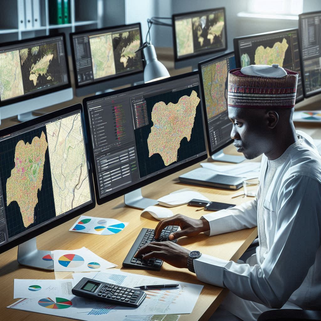
The future of cartography and Geographic Information Systems (GIS) in Nigeria is poised for significant advancements, promising transformative impacts across various sectors.
Brief Explanation of Cartography and GIS
Cartography, the science and art of mapmaking, involves the representation and analysis of geographical features and phenomena.
GIS, on the other hand, is a powerful tool that integrates spatial data to facilitate mapping, analysis, and decision-making.
Importance of Cartography and GIS in Nigeria
The significance of cartography and GIS in Nigeria cannot be overstated.
These tools are instrumental in urban planning, natural resource management, disaster response, infrastructure development, and public health, among other areas.
Overview of the Current State of Cartography and GIS in Nigeria
Nigeria has made strides in adopting GIS technology, with various government agencies, research institutions, and private organizations utilizing GIS for diverse applications.
However, challenges such as limited funding, inadequate infrastructure, and a shortage of skilled professionals hinder the full realization of the potential of cartography and GIS in Nigeria.
History of Cartography and GIS in Nigeria
Cartography and Geographic Information Systems (GIS) in Nigeria have a rich history that dates back to the colonial era.
During this period, the British colonialists utilized mapping techniques to demarcate territorial boundaries and create administrative maps for the efficient management of the country.
Evolution of Mapping Technologies in Nigeria
In the early days, mapping technologies in Nigeria were rudimentary, involving mostly hand-drawn maps and surveying techniques.
The accuracy and reliability of these maps were limited, leading to challenges in infrastructure development, land management, and disaster response.
Use of Traditional Mapping Methods in the Past
Traditional mapping methods, such as aerial photography and geodetic surveying, were later introduced to improve the quality of mapping in Nigeria.
However, these methods were still time-consuming and expensive, making them inaccessible to many organizations and individuals.
Introduction of GIS Technology in Nigeria
The introduction of Geographic Information Systems (GIS) technology revolutionized the field of cartography in Nigeria.
GIS allows for the digital mapping, analysis, and visualization of spatial data, enabling more accurate and efficient decision-making in various sectors.
With the advent of GIS technology, the Nigerian government and private organizations have been able to create detailed maps for urban planning, natural resource management, disaster risk reduction, and epidemiological studies.
GIS has also played a crucial role in improving land administration and reducing land disputes in Nigeria.
By digitizing land records and creating cadastral maps, GIS has enhanced transparency and efficiency in land management processes.
Challenges and Opportunities for Cartography and GIS in Nigeria
While GIS technology has brought significant advancements to the field of cartography in Nigeria, there are still challenges that need to be addressed.
One of the main challenges is the lack of skilled personnel with expertise in GIS and cartography.
Training programs and capacity-building initiatives are essential to develop a skilled workforce that can effectively utilize GIS technology for mapping and spatial analysis in Nigeria.
Additionally, there is a need for adequate funding and infrastructure to support the implementation of GIS projects across the country.
Despite these challenges, there are numerous opportunities for the future of cartography and GIS in Nigeria.
The continued integration of GIS technology into various sectors, such as agriculture, health, and transportation, will lead to improved data-driven decision-making and policy formulation.
Collaboration between government agencies, academic institutions, and private organizations is also crucial to leverage GIS technology for sustainable development in Nigeria.
By working together, stakeholders can harness the power of spatial data to address pressing societal issues and drive innovation in the country.
Basically, the future of cartography and GIS in Nigeria is bright, with the potential to transform how spatial data is collected, analyzed, and utilized for decision-making.
By overcoming current challenges and seizing opportunities for collaboration and capacity-building, Nigeria can harness the full potential of GIS technology for sustainable development and improved governance.
Read: Cartography and GIS Education in Nigeria
Challenges facing cartography and GIS in Nigeria
Despite the potential for growth in cartography and GIS in Nigeria, there are several challenges that hinder the progress of these technologies in the country.
Some of the major challenges include:
Lack of funding and resources
One of the main obstacles to the advancement of cartography and GIS in Nigeria is the lack of adequate funding and resources.
Government funding for mapping projects is often insufficient, leading to delays in data collection and map production.
Additionally, the high cost of GIS software and equipment makes it difficult for organizations to invest in these tools.
Limited skilled professionals in the field
Another challenge facing cartography and GIS in Nigeria is the shortage of skilled professionals in the field.
There is a lack of specialized training programs and courses in cartography and GIS, which has resulted in a limited pool of qualified individuals.
This shortage of skilled professionals hampers the development and implementation of mapping projects in the country.
Data collection and maintenance issues
Data collection and maintenance pose significant challenges to the effective use of cartography and GIS in Nigeria.
Inaccurate or outdated data can lead to errors in mapping and analysis, undermining the reliability of GIS applications.
Additionally, there is a lack of standardized data collection methods and protocols, making it difficult to compare and integrate different datasets.
Essentially, overcoming these challenges will be essential for the future of cartography and GIS in Nigeria.
Increased funding and resources, the development of training programs for professionals, and improved data collection and maintenance practices are necessary steps to harness the full potential of these technologies in the country.
Read: GIS Technology Advancements in Nigeria
Advancements in cartography and GIS technology in Nigeria
Nigeria is experiencing a significant transformation in cartography and Geographic Information Systems (GIS) technology, marking a pivotal moment in the nation’s mapping landscape.
These advancements are reshaping traditional mapping practices and opening new avenues for spatial data analysis and visualization.
Introduction of Modern Mapping Software
The introduction of modern mapping software has revolutionized the way cartographers and GIS professionals create, manipulate, and analyze geographic data.
With user-friendly interfaces and powerful analytical tools, these software solutions empower users to generate highly detailed and accurate maps, facilitating informed decision-making across various sectors.
Integration of Remote Sensing Technology
The integration of remote sensing technology has emerged as a game-changer in Nigeria’s mapping endeavors.
By harnessing data from satellite imagery, aerial drones, and other remote sensing platforms, cartographers can capture detailed spatial information over large areas with unprecedented precision.
This enables comprehensive mapping of land use, vegetation cover, urban development, and environmental changes, among other applications.
Use of Mobile Mapping Applications
The proliferation of mobile mapping applications has democratized access to geographic information, placing mapping capabilities directly into the hands of users.
These applications leverage the GPS capabilities of smartphones to collect spatial data, navigate surroundings, and access location-based services.
From mapping routes for transportation to identifying points of interest and conducting field surveys, mobile mapping applications have become indispensable tools for both professionals and the general public.
These advancements in cartography and GIS technology hold immense potential for driving innovation and development across diverse sectors in Nigeria.
Urban planners can utilize detailed maps and spatial analysis tools to optimize city infrastructure and urban development projects.
Agricultural professionals can leverage spatial data to monitor crop health, assess soil conditions, and enhance agricultural productivity.
Disaster management agencies can employ GIS technology to assess risks, plan emergency response strategies, and mitigate the impact of natural disasters on communities.
However, despite the progress made, challenges such as limited internet connectivity, insufficient funding, and a shortage of skilled professionals remain obstacles to fully harnessing the potential of cartography and GIS in Nigeria.
Addressing these challenges requires concerted efforts from government agencies, academic institutions, and the private sector to invest in infrastructure development, capacity building programs, and collaborative research initiatives.
In short, the future of cartography and GIS in Nigeria is promising, driven by ongoing advancements in technology and innovation.
By embracing modern mapping software, remote sensing technology, and mobile applications, Nigeria can unlock the transformative power of spatial data to address complex challenges, promote sustainable development, and improve the quality of life for its citizens.
Read: Impact of GIS on Nigerian Environment

Applications of cartography and GIS in Nigeria
Urban planning and development
Cartography and GIS play a crucial role in urban planning and development in Nigeria.
These technologies provide valuable data and insights for city planners to make informed decisions on infrastructure development, zoning regulations, and transportation networks.
By using GIS mapping tools, urban planners can analyze population distribution, traffic patterns, and land use in different areas of a city.
This data helps them identify areas that require improvements in services like water supply, waste management, and transportation.
GIS also aids in the visualization of proposed development projects, allowing planners to assess the potential impact on the surrounding environment and community.
By incorporating spatial analysis, they can determine the best locations for new residential areas, commercial zones, and public amenities.
Overall, cartography and GIS enhance urban planning efforts by enabling efficient decision-making, promoting sustainable development practices, and improving the quality of life for residents in Nigerian cities.
Natural resource management
In Nigeria, the use of cartography and GIS technology has revolutionized natural resource management practices.
These tools provide detailed mapping of natural resources such as forests, water bodies, and minerals, facilitating better environmental conservation and sustainable utilization.
GIS enables resource managers to monitor changes in land cover, assess deforestation rates, and track wildlife habitats.
By analyzing this spatial data, they can identify areas of ecological significance that require protection and restoration efforts.
Furthermore, cartography and GIS help in the management of water resources by mapping watersheds, assessing water quality, and monitoring freshwater availability.
This information is valuable for developing strategies to address water scarcity, prevent pollution, and promote efficient irrigation practices in agriculture.
Overall, the application of cartography and GIS in natural resource management enhances environmental monitoring, promotes biodiversity conservation, and supports sustainable utilization of Nigeria’s rich natural resources.
Disaster response and mitigation
Cartography and GIS technologies are essential tools for disaster response and mitigation efforts in Nigeria.
These technologies provide critical spatial information that helps emergency responders and disaster management authorities make timely and effective decisions during crises.
GIS mapping tools enable the visualization of vulnerable areas, evacuation routes, and emergency shelters, aiding in the preparation and response to natural disasters such as floods, droughts, and epidemics.
By analyzing elevation data, flood risk maps, and population density, authorities can prioritize areas for disaster preparedness and mitigation measures.
Cartography and GIS aid post-disaster recovery by mapping damaged infrastructure, assessing impact, and coordinating relief efforts.
This information is crucial for allocating resources, conducting damage assessments, and planning reconstruction projects in affected communities.
Overall, integrating cartography and GIS in disaster response enhances emergency preparedness and minimizes disaster impact in Nigeria.
Read: Challenges in Nigerian Curriculum Studies
Learn More: Challenges in Nigeria’s Electrical Engineering Sector
Opportunities for Cartography and GIS in Nigeria
The future of cartography and GIS in Nigeria is promising, with numerous opportunities for growth and development in the field.
The country’s potential for economic growth and development is vast, and the use of mapping services and GIS technology can play a significant role in driving this growth.
Potential for Economic Growth and Development
One of the main opportunities for cartography and GIS in Nigeria is the potential for economic growth and development.
Through mapping services and GIS technology, Nigeria can efficiently manage resources, plan infrastructure, and make informed decisions for economic prosperity.
Increased Demand for Mapping Services
Nigeria witnesses a rising demand for mapping services across industries like urban planning, agriculture, transportation, and natural resource management.
As the demand for accurate, up-to-date maps grows, cartographers and GIS professionals have significant opportunities to thrive in Nigeria.
Collaboration with International Organizations and Governments
Collaborating with international organizations and governments, Nigeria gains knowledge sharing, tech transfer, and funding to advance cartography and GIS.
This collaboration can foster innovative mapping solutions addressing the country’s unique challenges and contributing to overall development.
Ultimately, Nigeria’s future in cartography and GIS shines bright, offering economic growth, increased mapping service demand, and international collaboration.
Embracing opportunities and leveraging mapping technology’s power, Nigeria can lead in geospatial innovation, advancing sustainable development.
Explore Further: Advanced Welding Equipment in Nigeria
Find Out More: Impact of Climate on Structural Engineering in Nigeria
You Might Also Like: Importance of Accurate Cost Estimation in Projects
Discover More: Polymer and Textile Engineering Internships in Nigeria
Delve into the Subject: Electrical Engineering Professional Bodies in Nigeria
You Might Also Like: Internship Tips for Nigerian Computer Engineering Students
Discover More: Telecommunication Infrastructure in Nigeria
Future trends in cartography and GIS in Nigeria
In recent years, the field of cartography and GIS in Nigeria has seen significant advancements and promising future trends.
One of the key areas that is expected to continue growing is the expansion of digital mapping services.
As technology reliance grows for various applications, the demand for accurate, up-to-date mapping data increases.
Real-time updates and customization options offered by digital mapping services surpass those of traditional methods.
Expansion of digital mapping services
Digital mapping services are vital across sectors like transportation, agriculture, and disaster response, from navigation tools to urban planning.
In Nigeria, the expansion of these services is expected to lead to more efficient and effective decision-making processes.
A primary challenge in Nigerian cartography and GIS is the limited availability of accurate, detailed mapping data.
By expanding digital mapping services, organizations can bridge this gap and provide better access to geospatial information.
Transform Your Career with Expert Guidance
Get personalized mentorship consulting that’s tailored to your unique path. Our expert advice is actionable and exclusive.
Get StartedIntegration of artificial intelligence and machine learning
Another future trend in cartography and GIS is the integration of artificial intelligence (AI) and machine learning technologies.
These advanced tools can analyze large volumes of data and generate insights that were previously impossible to obtain.
In Nigeria, AI and machine learning enhance mapping accuracy, automate data processing, and predict future trends from historical data.
This integration is expected to revolutionize how geospatial information is used in various applications.
Development of spatial data infrastructure
To meet the rising demand for mapping services and integrate AI, machine learning, developing SDI is crucial.
SDI provides the framework for collecting, managing, and sharing geospatial data effectively.
Investing in SDI allows Nigeria to create an interconnected, efficient mapping ecosystem benefiting public and private sectors.
This infrastructure will enable better coordination, data sharing, and collaboration among stakeholders in the field of cartography and GIS.
Summing up, Nigeria’s future in cartography and GIS sees expanded digital mapping, integrated AI, and developing spatial data infrastructure.
These trends are expected to drive innovation, improve decision-making processes, and enhance the use of geospatial information across various sectors.
Uncover the Details: Common Misconceptions About Quantity Surveying
See Related Content: Women in Polymer and Textile Engineering in Nigeria
See Related Content: Notable Glass and Silicate Researchers in Nigeria
You Might Also Like: Building a Career in Computer Engineering in Nigeria
Conclusion
In closing, the future of cartography and Geographic Information Systems (GIS) in Nigeria holds immense promise for driving progress and innovation across diverse sectors.
Summary of Key Points Discussed
Throughout this discussion, we’ve explored the significant advancements in mapping technologies, from the introduction of modern mapping software to the integration of remote sensing technology.
These innovations offer unprecedented opportunities for spatial data analysis, visualization, and decision-making in Nigeria.
Importance of Investing in the Future of Cartography and GIS in Nigeria
Investing in the future of cartography and GIS in Nigeria is crucial for addressing complex societal challenges, enhancing resource management, and fostering sustainable development.
By leveraging the power of spatial data, Nigeria can make informed decisions, optimize infrastructure development, and improve the quality of life for its citizens.
Call to Action for Government and Private Sector Investment in Mapping Technologies
To realize the full potential of cartography and GIS in Nigeria, it is imperative for both the government and the private sector to prioritize investment in mapping technologies.
This includes funding research and development initiatives, expanding infrastructure, and supporting capacity-building programs.
By working together, Nigeria can harness the transformative power of cartography and GIS to build a brighter and more prosperous future for all.