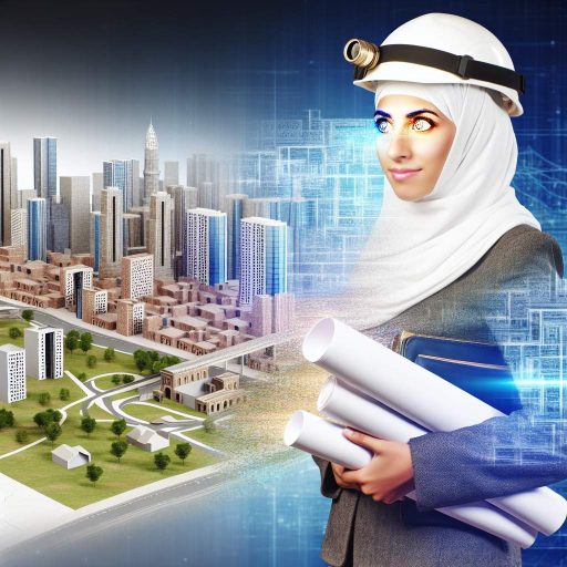
Introduction
GIS, or Geographic Information System, is a technology that allows users to analyze and visualize spatial data.
Remote Sensing involves collecting information about an object without physical contact.
In modern agricultural practices, GIS and Remote Sensing play a crucial role in increasing efficiency and productivity.
These technologies are used in various ways to optimize agricultural engineering processes.
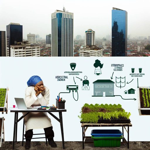
Mapping and Analysis of Agricultural Lands using GIS
GIS (Geographic Information System) plays a crucial role in the mapping and analysis of agricultural lands.
It provides valuable insights for farmers and agricultural engineers.
Use of GIS to Create Accurate Maps of Agricultural Lands
One of the primary uses of GIS in agricultural engineering is to create accurate maps of agricultural lands.
GIS technology allows professionals to digitize and map out the boundaries of fields.
This provides precise measurements and boundaries for each plot of land.
This information is invaluable for planning and executing various agricultural activities.
Analysis of Soil Types, Slope, and Drainage Patterns for Optimal Crop Production
Another important application of GIS in agricultural engineering is the analysis of soil types, slope, and drainage patterns.
This analysis is essential for optimal crop production.
By overlaying soil data, elevation data, and drainage patterns on GIS maps, agricultural engineers can identify areas within a field.
These areas may be more suitable for certain crops based on soil composition and water availability.
This information helps farmers make informed decisions about crop selection and planting strategies.
Application of GIS in Precision Agriculture for Efficient Resource Management
GIS technology is also utilized in precision agriculture.
This farming approach uses data and technology to optimize crop yields while minimizing inputs.
Inputs such as water, fertilizers, and pesticides can be optimized.
By integrating GPS data with GIS maps, farmers can create variable rate application maps.
These maps guide equipment to apply inputs only where they are needed.
This reduces waste and maximizes efficiency.
The precision agriculture approach helps farmers improve their bottom line.
It optimizes resource management and reduces environmental impact.
GIS and remote sensing technologies have revolutionized the field of agricultural engineering.
They provide valuable tools for mapping, analyzing, and managing agricultural lands.
These technologies play a pivotal role in increasing productivity, sustainability, and efficiency in modern agriculture.
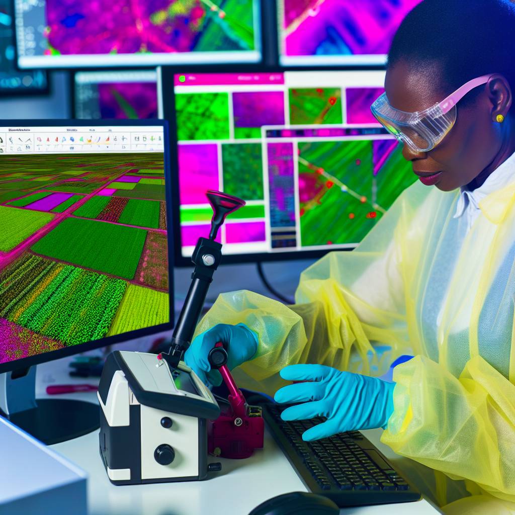
Monitoring Crop Health and Growth Using Remote Sensing
Remote sensing plays a crucial role in monitoring crop health and growth in agricultural engineering.
By utilizing satellite imagery, researchers and farmers can obtain valuable data that helps in making informed decisions about their crops.
- Use of satellite imagery to monitor crop health and growth
- Detection of diseases, pests, and nutrient deficiencies through remote sensing
- Importance of timely interventions based on remote sensing data
Utilizing Satellite Imagery for Monitoring Crop Health:
Satellite imagery provides a bird’s eye view of the entire agricultural field.
It allows for the efficient monitoring of crop health and growth.
By accessing these images, farmers can identify areas of distress or underperformance in their crops.
Detection of Diseases, Pests, and Nutrient Deficiencies:
Remote sensing technology enables the detection of diseases, pests, and nutrient deficiencies in crops.
By analyzing the data obtained from satellite imagery, agricultural engineers can pinpoint specific issues affecting crop health.
They can then take appropriate actions to mitigate them.
Importance of Timely Interventions Based on Remote Sensing Data:
Timely interventions are crucial in ensuring the optimal growth and health of crops.
By using remote sensing data, farmers can identify problems early on.
This early detection allows them to implement necessary interventions promptly.
A proactive approach can prevent significant crop losses and ultimately lead to higher yields.
Remote sensing technology offers valuable insights into monitoring crop health and growth in agricultural engineering.
By leveraging satellite imagery and analyzing data effectively, farmers and researchers can make informed decisions to ensure the success of their crops.
Transform Your Career with Expert Guidance
Get personalized mentorship consulting that’s tailored to your unique path. Our expert advice is actionable and exclusive.
Get StartedRemote sensing has revolutionized the way we approach agricultural practices.
It enables sustainable and efficient crop management strategies.
Delve into the Subject: Government Policies on Networking Security in Nigeria
Forecasting and managing agricultural risks with GIS
In the field of agricultural engineering, the ability to anticipate and manage risks is crucial for ensuring the sustainability and productivity of agricultural activities.
GIS (Geographic Information System) plays a vital role in forecasting and managing agricultural risks effectively.
- Utilizing GIS for weather forecasting and climate prediction
- Mapping and monitoring natural disasters such as floods, droughts, and wildfires
- Implementing risk management strategies based on GIS data to mitigate potential losses
GIS technology enables agricultural engineers to gather, analyze, and visualize various environmental data, including weather patterns and climate trends.
By utilizing GIS tools, experts can generate accurate forecasts for weather conditions, seasonal changes, and long-term climate predictions.
Utilizing GIS for weather forecasting and climate prediction
GIS allows agricultural engineers to create detailed maps that highlight vulnerable areas prone to natural disasters like floods, droughts, and wildfires.
By monitoring these regions using GIS technology, experts can promptly respond to emergencies, assess damages, and implement disaster recovery plans.
Implementing risk management strategies based on GIS data to mitigate potential losses
By utilizing GIS data on weather patterns, soil quality, crop health, and other relevant factors, agricultural engineers can develop comprehensive risk management strategies.
These strategies involve proactive measures to reduce the impact of potential risks, such as implementing irrigation systems, crop rotation techniques, and disaster preparedness programs.
GIS and remote sensing technology play a vital role in forecasting and managing agricultural risks.
By leveraging GIS tools for weather forecasting, mapping natural disasters, and implementing risk management strategies, agricultural engineers can enhance the resilience and sustainability of agricultural systems.
This ensures food security for future generations.
See Related Content: Government Policies on Biomedical Engineering in Nigeria
Enhancing irrigation efficiency with GIS and Remote Sensing
One of the key benefits of using GIS and Remote Sensing in agricultural engineering is the enhancement of irrigation efficiency.
Optimizing water usage through GIS-based irrigation systems
GIS technology allows farmers to create precise irrigation schedules based on data such as soil type, topography, and crop type.
By analyzing this data, farmers can ensure that water is distributed evenly and efficiently across their fields, reducing waste and maximizing crop yields.
Monitoring soil moisture levels and crop water requirements using remote sensing data
Remote sensing technology enables farmers to monitor soil moisture levels and crop water requirements in real-time.
By using satellite imagery and sensors, farmers can adjust their irrigation schedules to meet the specific needs of their crops, leading to healthier plants and increased yields.
Improving crop yields and reducing water wastage with precise irrigation techniques
By combining GIS and Remote Sensing data, farmers can implement precise irrigation techniques such as drip irrigation or precision agriculture.
These techniques help farmers to target water delivery directly to the roots of plants, reducing evaporation and water wastage, ultimately improving crop yields and conserving water resources.
The role of GIS and Remote Sensing in agricultural engineering is crucial for enhancing irrigation efficiency, optimizing water usage, monitoring soil moisture levels, and improving crop yields.
By utilizing these technologies, farmers can achieve sustainable agriculture practices and contribute to a more efficient and productive farming industry.
Learn More: Challenges Facing Biomedical Engineering in Nigeria
Integrating GIS and Remote Sensing in Precision Agriculture
Advantages of combining GIS, Remote Sensing, and GPS technologies in precision agriculture:
- Enhanced Decision-Making: By integrating GIS, Remote Sensing, and GPS data, farmers can make more informed decisions about their crops.
- Optimized Resource Management: Precision agriculture techniques help in utilizing resources efficiently, leading to cost savings.
- Improved Crop Monitoring: GIS and Remote Sensing provide real-time information on crop health, allowing for timely interventions.
- Enhanced Sustainability: By implementing precision agriculture practices, farmers can adopt sustainable methods for long-term agricultural productivity.
Implementing site-specific crop management practices based on spatial data:
- Variable Rate Application: Adjusting input rates based on spatial variability to optimize crop yield.
- Zoning and Prescription Maps: Creating management zones and prescriptions for targeted interventions.
- Yield Mapping: Using GIS data to generate yield maps for analyzing productivity across different sections of the field.
- Soil Analysis: Conducting soil tests and mapping soil properties to guide fertilizer application.
Increasing productivity and sustainability of agricultural operations through precision agriculture techniques:
- Water Management: Precision agriculture helps in efficient water use through irrigation scheduling and water-saving technologies.
- Pest and Disease Control: Early detection of pests and diseases using Remote Sensing aids in timely pest management.
- Climate Resilience: GIS data can be used to assess climate risks and implement adaptation strategies for resilient agriculture.
- Economic Benefits: Precision agriculture leads to higher yields, reduced input costs, and improved profitability for farmers.
Integrating GIS and Remote Sensing in precision agriculture offers a multitude of benefits ranging from enhanced decision-making to increased sustainability, paving the way for a more efficient and productive agricultural sector.
Discover More: Land Surveying and Land Dispute Resolution in Nigeria
GIS and Remote Sensing in Agriculture
GIS and Remote Sensing play a crucial role in agricultural engineering.
They provide essential data for decision-making in farming practices.
The significance of these technologies cannot be overstated.
They contribute to improved crop management and resource optimization.
Additionally, these tools aid in promoting environmental sustainability.
It is imperative for agricultural practitioners to embrace GIS and Remote Sensing tools.
Doing so enhances their practices effectively.
This approach ultimately leads to the achievement of sustainable agriculture.
Additional Resources
Multicriteria GIS-based assessment of biomass energy … – Frontiers
Idowu Ezekiel Olorunfemi – Google Scholar